Maps of Madagascar

Located off the coast of East Africa in the Indian Ocean, Madagascar is the second-largest island country in the world. It covers an area of t 592,800 sq. kilometers. The country can be divided into three parallel longitudinal physiographic regions. The coastal strip in the east, the central plateau, and the western regions of low plateaus and plains.
Madagascar's eastern coast has a steep, narrow escarpment that runs along it, and the island's remaining tropical rainforest are located here. Along the west coast of the island swamps of mangroves give way to deep bays. Moving inland, the central highlands are punctuated by grassy, deforested hills bordering valleys known for cultivating rice and other food.
Tsaratanana Massif region at the northern end of the island is home to Madagascar's highest point, Maromokotro at 2,876 m. The point has been marked on the map with an upright yellow triangle. In the center, the Ankaratra Massif (marked on the map) is a major volcanic mass with the highest peak at 2,643 m. Madagascar's lowest point is the Indian Ocean at 0 m
Major rivers of Madagascar include the Mananara, Mangoro Sambirano, Mahajamba, Betsiboka, Mania, north and south Mahavavy, Mangoky, Onilahy, and the Ikopa; lakes include Alaotra, Lake Kinkony, and Lake Ihotry.
Isalo and Masoala National Parks can be found in the southern and northeastern parts of Madagascar. Both of these parks are home to some of the island's rare animals, birds, and fauna. Including the forever-famous lemurs that can only be found in Madagascar.
Provinces of Madagascar Map

Madagascar is divided into 6 provinces (faritany). In alphabetical order, these are Antananarivo, Antsiranana, Fianarantsoa, Mahajanga, Toamasina, and Toliara. Antananarivo is both the largest city in the nation as well as the capital of the country. This sprawling city can be found in the Antananarivo region.
Where is Madagascar?

Madagascar is an island country of Africa. It is located around 400 km off the coast of East Africa in the Indian Ocean with the nearest mainland African country being Mozambique. It is located in the Southern and Eastern Hemispheres of the Earth. The island country of Mauritius and Réunion (territory of France), lie to the east of Madagascar. To the northwest are the French territory of Mayotte and the island country of Comoros.
Regional Maps: Map of Africa
Outline Map of Madagascar


Key Facts
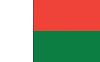
| Legal Name | Republic of Madagascar |
|---|---|
| Flag |
|
| Capital City | Antananarivo |
| 18 55 S, 47 31 E | |
| Total Area | 587,041.00 km2 |
| Land Area | 581,540.00 km2 |
| Water Area | 5,501.00 km2 |
| Population | 26,969,307 |
| Major Cities |
|
| Currency | Malagasy ariary (MGA) |
| GDP | $14.08 Billion |
| GDP Per Capita | $522.22 |
This page was last updated on December 5, 2023