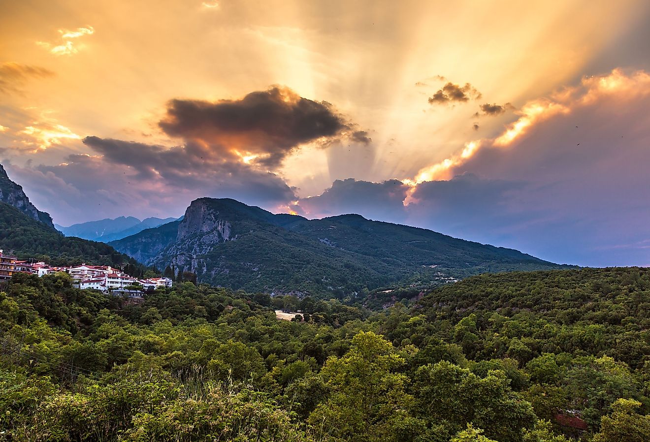
Is Florida A Peninsula?
A peninsula is a piece of land that is bordered by water on most but not all sides while still being connected to the mainland. The Sunshine State, Florida, is bordered by the Gulf of Mexico to the west, the Atlantic Ocean to the east, and the Straits of Florida to the south, while the northern part of the state connects to the rest of the United States, particularly to the states of Alabama and Georgia. This geographical feature makes Florida one of the most recognizable peninsulas in the world. How did Florida take shape as a Peninsula? What historical implications did this unique geographical feature have on the state?
Formation Of Florida’s Peninsula

The peninsula consists primarily of karst limestone and sits on the Florida Platform, a porous plateau. It formed along northwest Africa an estimated 530 million years ago. This means that in its earliest form, Florida was part of Gondwanaland, a supercontinent that split into different landmasses. The Florida Plateau also formed around 530 million years ago and is the result of volcanic activity and other geological processes.
At the start of the Cenozoic Era, Florida became submerged under a shallow, warm ocean. This event helps explain the state’s current flat topography and the existence of several marine formations. Florida. as it exists today, is a relatively recent geological phenomenon, with the peninsula and its landscapes having developed over time. The Florida Escarpment indicates the western edge of a large carbonate platform surrounding the peninsula.
Florida’s Geography

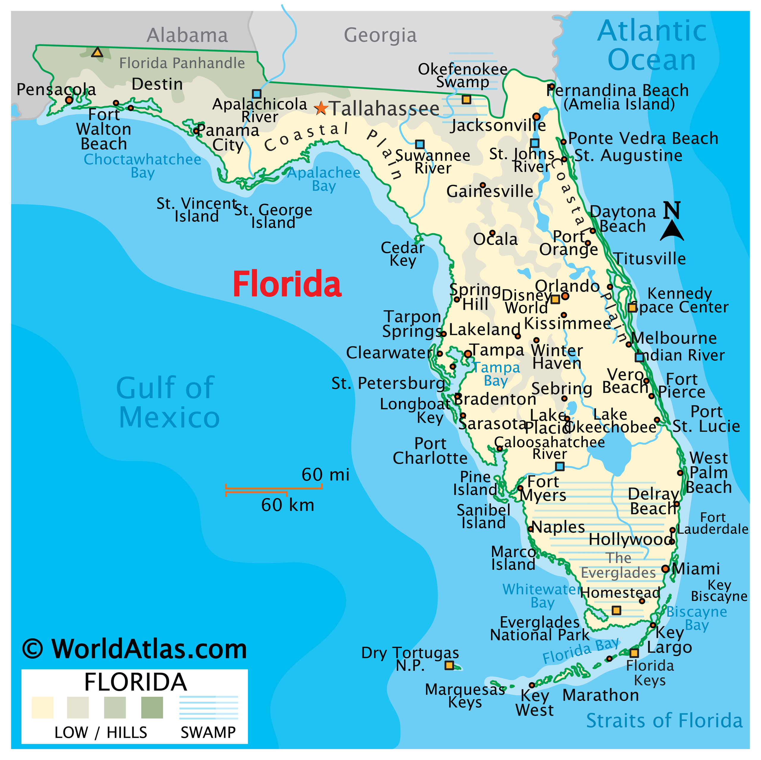
Today, Florida lies within the southeastern US. Water flows on three sides of the state, with the Atlantic to the east and the Gulf to the west. The state’s southern tip extends into the Straits of Florida and marks the joining of the frigid ocean and the Gulf. Other than being a peninsula, Florida is home to three physiographic provinces:

Gulf Coastal Lowlands
Where Florida’s western border meets the Gulf, the geography of the landscape changes to coastal plains, marshes, and estuaries. Here, there are breathtaking beachscapes, and the unique ecosystem is supported by the proximity to the Gulf.
Atlantic Coastal Lowlands
On the eastern side, there are also coastal plains, but they are accompanied by barrier islands. The Atlantic Coastal Lowlands is a haven of diverse landscapes and habitats, adding to the beauty that Florida is known for.
Interior Highlands
Inland Florida features the Interior Highlands, which come with a change in elevation and topography. Rolling hills and higher plains influence biodiversity and rainfall patterns.
Features Unique To The Floridian Peninsula

One of the most unique features of Florida’s geography is the world-famous Florida Keys. This coral cay archipelago extends from Florida’s southern end, and this magnificent island chain is renowned for its abundant marine life and colorful coral reefs. Moreover, Florida’s Everglades also define the landscape of the state. In the Everglades, a subtropical wetland in the southern region, the water moves slowly, and the sawgrass marshes thrive. Several animal and plant species also flourish here.
Historical Significance Of The Floridian Peninsula

Timucua Indians of Florida region at a column erected by the French in 1562. They believed it to be their God, and hence, worshipped it.
The Floridian peninsula occupies an important space in history books. Florida’s history dates back around 14,000 years, when the first Native Americans inhabited the peninsula. These early inhabitants, the Paleo-Indians, identified the region as a new food source. Furthermore, Florida’s European history reflects the conflicts among several nations’ crowns for wealth and empire. It was explorer Juan Ponce de Leon who helped explore and colonize Florida, claiming it for Spain and calling the peninsula La Florida. Florida was the central location of the Seminole Wars between 1816 and 1858, which made it the site of the most extensive Indian Wars in US history. The northeastern side of the state, including St. Augustine, played a strategic part in its history. It was a vital area for the Spanish because of the Treasure Fleet’s route, which followed the Gulf Stream.
Florida’s status as a peninsula holds broader implications for the so-called peninsula effect. This effect is a biological diversity pattern researchers observed in peninsulas where the number of species decreases towards the tip of the landmass. The Floridian Peninsula aligns with this pattern. Lake Wales Ridge, Brooksville Ridge, Mount Dora Ridge, and Trail Ridge showcase this. These varied landscapes also contribute to Florida’s celebrated flora and fauna, underlining the peninsula’s significance as part of the local ecosystem. This also means that Florida is much more than just a classified peninsula. It is a hub for biodiversity and ecological growth, which must remain protected at all costs, especially against the ever-increasing threat of climate change.