Where is Kenosha County, Wisconsin?
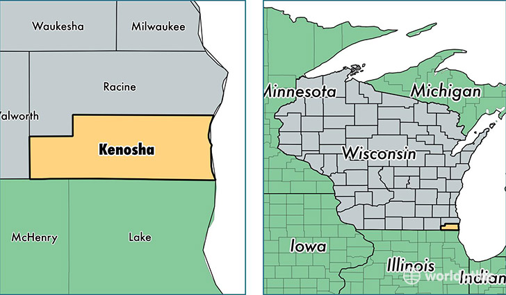
Kenosha County is a county equivalent area found in Wisconsin, USA. The county government of Kenosha is found in the county seat of Kenosha.
With a total 1,952.92 sq. km of land and water area, Kenosha County, Wisconsin is the 1273rd largest county equivalent area in the United States. Home to 168,068 people, Kenosha County has a total 69354 households earning 54930 on average per year.
Kenosha County, Wisconsin - Quick Facts
| FIPS Code | 55059 |
| Area Codes | 262 |
| Time Zone | CST |
| Major Cities | Kenosha (population: 113,935), Pleasant Prairie (population: 16,061), Salem (population: 8,721), Twin Lakes (population: 7,423), Trevor (population: 6,367), Bristol (population: 5,475), Silver Lake (population: 2,401), Wilmot (population: 218) |
| Land Area | 64,891 sq miles |
| Water Area | 272 sq miles |
| Household Income | $54,930 |
| Housing Units | 69,354 |
| Median Home Value | $169,600 |
| High School Grads | 89% of population |
| Holders of Bachelors Degrees | 23% of population |
| Retail Spending | $11,055 per capita |
| Food & Accomodation Sales | $214,034 per capita |
This page was last updated on June 30, 2016.