Where is Lancaster County, Pennsylvania?
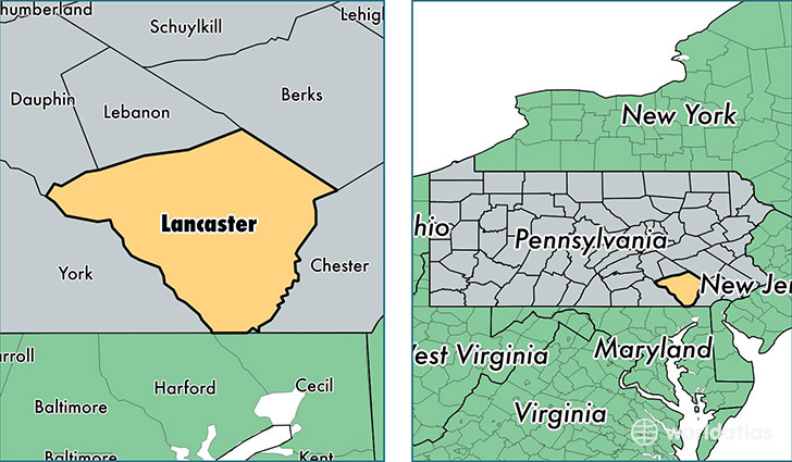
Lancaster County is a county equivalent area found in Pennsylvania, USA. The county government of Lancaster is found in the county seat of Lancaster.
With a total 2,548.04 sq. km of land and water area, Lancaster County, Pennsylvania is the 792nd largest county equivalent area in the United States. Home to 533,320 people, Lancaster County has a total 205023 households earning 56483 on average per year.
Lancaster County, Pennsylvania offers the following attractions to visitors: Woodward Hill Cemetary (James Buchanan), Dutch Wonderland
Lancaster County, Pennsylvania - Quick Facts
| FIPS Code | 42071 |
| Area Codes | 717,610 |
| Time Zone | EST |
| Major Cities | Lancaster (population: 166,933), Lititz (population: 43,231), Ephrata (population: 32,944), Elizabethtown (population: 29,994), Manheim (population: 21,557), Columbia (population: 18,089), Mount Joy (population: 18,084), Denver (population: 15,609), New Holland (population: 14,007), Quarryville (population: 12,189) |
| Land Area | 205,916 sq miles |
| Water Area | 944 sq miles |
| Household Income | $56,483 |
| Housing Units | 205,023 |
| Median Home Value | $188,200 |
| High School Grads | 84% of population |
| Holders of Bachelors Degrees | 24% of population |
| Retail Spending | $13,101 per capita |
| Food & Accomodation Sales | $763,937 per capita |
| Universities and Colleges | Elizabethtown College, Empire Beauty School-Lancaster, Franklin and Marshall College, Lancaster School of Cosmetology, Millersville University of Pennsylvania, Pennsylvania College of Art and Design |
This page was last updated on June 30, 2016.