Where is Chester County, Pennsylvania?
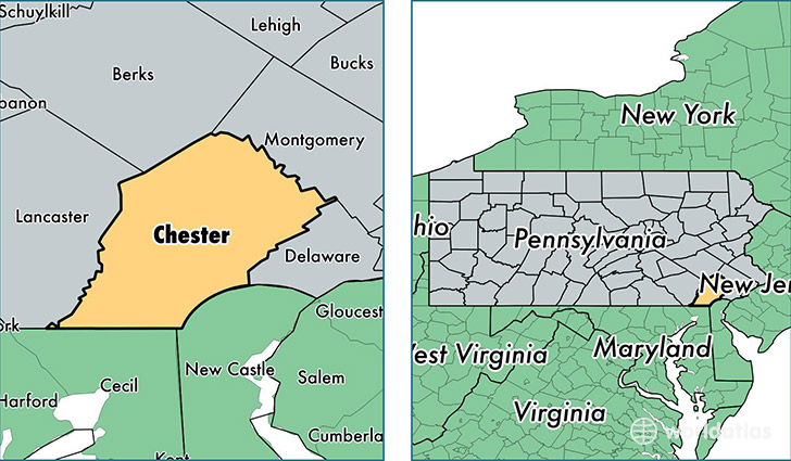
Chester County is a county equivalent area found in Pennsylvania, USA. The county government of Chester is found in the county seat of West Chester.
With a total 1,966.41 sq. km of land and water area, Chester County, Pennsylvania is the 1265th largest county equivalent area in the United States. Home to 512,784 people, Chester County has a total 194329 households earning 86050 on average per year.
Chester County, Pennsylvania - Quick Facts
| FIPS Code | 42029 |
| Area Codes | 610 |
| Time Zone | EST |
| Major Cities | West Chester (population: 106,698), Coatesville (population: 53,148), Downingtown (population: 47,708), Phoenixville (population: 40,750), Malvern (population: 25,141), Kennett Square (population: 22,574), Oxford (population: 17,317), Pottstown (population: 17,300), Exton (population: 16,966), Chester Springs (population: 14,136) |
| Land Area | 197,987 sq miles |
| Water Area | 751 sq miles |
| Household Income | $86,050 |
| Housing Units | 194,329 |
| Median Home Value | $325,200 |
| High School Grads | 93% of population |
| Holders of Bachelors Degrees | 49% of population |
| Retail Spending | $23,255 per capita |
| Food & Accomodation Sales | $783,220 per capita |
| Universities and Colleges | Immaculata University, Cheyney University of Pennsylvania |
This page was last updated on June 30, 2016.