Where is Clermont County, Ohio?
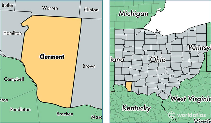
Clermont County is a county equivalent area found in Ohio, USA. The county government of Clermont is found in the county seat of Batavia.
With a total 1,190.79 sq. km of land and water area, Clermont County, Ohio is the 2317th largest county equivalent area in the United States. Home to 201,560 people, Clermont County has a total 81381 households earning 60365 on average per year.
Clermont County, Ohio - Quick Facts
| FIPS Code | 39025 |
| Area Codes | 513,937 |
| Time Zone | EST |
| Major Cities | Loveland (population: 53,718), Cincinnati (population: 47,375), Batavia (population: 31,759), Milford (population: 31,667), Amelia (population: 22,877), Bethel (population: 12,433), Goshen (population: 11,156), New Richmond (population: 9,843), Williamsburg (population: 9,118), Felicity (population: 3,692) |
| Land Area | 77,823 sq miles |
| Water Area | 452 sq miles |
| Household Income | $60,365 |
| Housing Units | 81,381 |
| Median Home Value | $154,500 |
| High School Grads | 88% of population |
| Holders of Bachelors Degrees | 26% of population |
| Retail Spending | $12,577 per capita |
| Food & Accomodation Sales | $239,467 per capita |
This page was last updated on June 30, 2016.