Where is Somerset County, New Jersey?
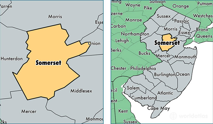
Somerset County is a county equivalent area found in New Jersey, USA. The county government of Somerset is found in the county seat of Somerville.
With a total 789.47 sq. km of land and water area, Somerset County, New Jersey is the 2840th largest county equivalent area in the United States. Home to 332,568 people, Somerset County has a total 125077 households earning 99020 on average per year.
Somerset County, New Jersey - Quick Facts
| FIPS Code | 34035 |
| Area Codes | 908,609,732 |
| Time Zone | EST |
| Major Cities | Somerset (population: 50,578), Hillsborough (population: 38,872), Bridgewater (population: 38,472), Basking Ridge (population: 27,099), Somerville (population: 22,465), Warren (population: 15,512), Bound Brook (population: 12,415), Belle Mead (population: 11,466), Manville (population: 10,480), Franklin Park (population: 9,134) |
| Land Area | 128,405 sq miles |
| Water Area | 302 sq miles |
| Household Income | $99,020 |
| Housing Units | 125,077 |
| Median Home Value | $398,800 |
| High School Grads | 93% of population |
| Holders of Bachelors Degrees | 51% of population |
| Retail Spending | $17,946 per capita |
| Food & Accomodation Sales | $656,131 per capita |
| Universities and Colleges | Raritan Valley Community College, Somerset Christian College, Robert Fiance Beauty School |
This page was last updated on June 30, 2016.