Where is Knox County, Maine?
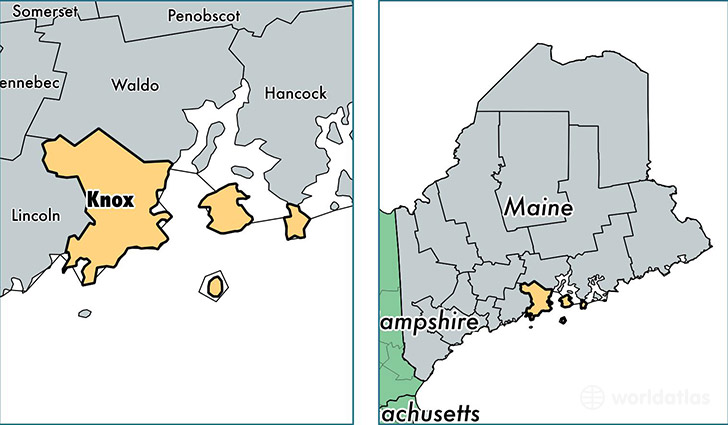
Knox County is a county equivalent area found in Maine, USA. The county government of Knox is found in the county seat of Rockland.
With a total 2,962.8 sq. km of land and water area, Knox County, Maine is the 627th largest county equivalent area in the United States. Home to 39,676 people, Knox County has a total 23818 households earning 49755 on average per year.
Knox County, Maine - Quick Facts
| FIPS Code | 23013 |
| Area Codes | 207 |
| Time Zone | EST |
| Major Cities | Rockland (population: 7,284), Camden (population: 4,842), Warren (population: 4,742), Union (population: 3,585), Rockport (population: 3,324), Thomaston (population: 2,776), Tenants Harbor (population: 1,588), Owls Head (population: 1,577), Hope (population: 1,533), Cushing (population: 1,531) |
| Land Area | 15,319 sq miles |
| Water Area | 365 sq miles |
| Household Income | $49,755 |
| Housing Units | 23,818 |
| Median Home Value | $195,700 |
| High School Grads | 93% of population |
| Holders of Bachelors Degrees | 30% of population |
| Retail Spending | $15,659 per capita |
| Food & Accomodation Sales | $90,110 per capita |
This page was last updated on June 30, 2016.