Where is Gallatin County, Kentucky?
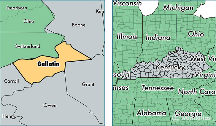
Gallatin County is a county equivalent area found in Kentucky, USA. The county government of Gallatin is found in the county seat of Warsaw.
With a total 271.22 sq. km of land and water area, Gallatin County, Kentucky is the 3095th largest county equivalent area in the United States. Home to 8,589 people, Gallatin County has a total 3793 households earning 43793 on average per year.
Gallatin County, Kentucky - Quick Facts
| FIPS Code | 21077 |
| Area Codes | 859 |
| Time Zone | EST |
| Major Cities | Verona (population: 3,576), Warsaw (population: 3,494) |
| Land Area | 3,316 sq miles |
| Water Area | 98 sq miles |
| Household Income | $43,793 |
| Housing Units | 3,793 |
| Median Home Value | $98,400 |
| High School Grads | 75% of population |
| Holders of Bachelors Degrees | 9% of population |
| Retail Spending | $4,619 per capita |
This page was last updated on June 30, 2016.