Where is Gove County, Kansas?
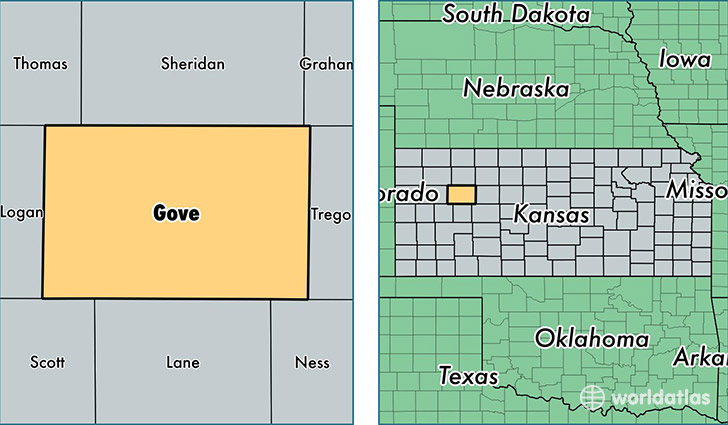
Gove County is a county equivalent area found in Kansas, USA. The county government of Gove is found in the county seat of Gove.
With a total 2,775.84 sq. km of land and water area, Gove County, Kansas is the 695th largest county equivalent area in the United States. Home to 2,727 people, Gove County has a total 1378 households earning 44866 on average per year.
Gove County, Kansas - Quick Facts
| FIPS Code | 20063 |
| Area Codes | 785 |
| Time Zone | CST |
| Major Cities | Quinter (population: 1,415), Grainfield (population: 448), Park (population: 261), Gove (population: 230) |
| Land Area | 1,053 sq miles |
| Water Area | 1,072 sq miles |
| Household Income | $44,866 |
| Housing Units | 1,378 |
| Median Home Value | $71,500 |
| High School Grads | 93% of population |
| Holders of Bachelors Degrees | 20% of population |
| Retail Spending | $6,552 per capita |
| Food & Accomodation Sales | $2,010 per capita |
This page was last updated on June 30, 2016.