Where is Vermillion County, Indiana?
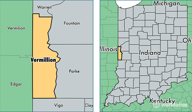
Vermillion County is a county equivalent area found in Indiana, USA. The county government of Vermillion is found in the county seat of Newport.
With a total 673.22 sq. km of land and water area, Vermillion County, Indiana is the 2924th largest county equivalent area in the United States. Home to 15,693 people, Vermillion County has a total 7407 households earning 42524 on average per year.
Vermillion County, Indiana - Quick Facts
| FIPS Code | 18165 |
| Area Codes | 765 |
| Time Zone | EST |
| Major Cities | Clinton (population: 9,979), Cayuga (population: 2,025), Perrysville (population: 1,173), Dana (population: 1,065), Hillsdale (population: 839), Newport (population: 456), Universal (population: 226) |
| Land Area | 6,059 sq miles |
| Water Area | 257 sq miles |
| Household Income | $42,524 |
| Housing Units | 7,407 |
| Median Home Value | $75,100 |
| High School Grads | 89% of population |
| Holders of Bachelors Degrees | 13% of population |
| Retail Spending | $11,296 per capita |
| Food & Accomodation Sales | $16,305 per capita |
This page was last updated on June 30, 2016.