Where is Jo Daviess County, Illinois?
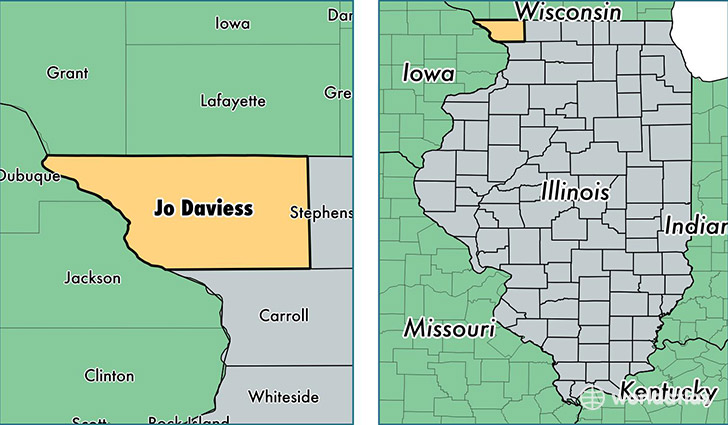
Jo Daviess County is a county equivalent area found in Illinois, USA. The county government of Jo Daviess is found in the county seat of Galena.
With a total 1,602.12 sq. km of land and water area, Jo Daviess County, Illinois is the 1680th largest county equivalent area in the United States. Home to 22,254 people, Jo Daviess County has a total 13553 households earning 50817 on average per year.
Jo Daviess County, Illinois - Quick Facts
| FIPS Code | 17085 |
| Area Codes | 815 |
| Time Zone | CST |
| Major Cities | Galena (population: 6,782), East Dubuque (population: 4,839), Stockton (population: 3,423), Elizabeth (population: 1,977), Warren (population: 1,660), Hanover (population: 1,319), Apple River (population: 1,172), Scales Mound (population: 952), Nora (population: 140) |
| Land Area | 8,592 sq miles |
| Water Area | 601 sq miles |
| Household Income | $50,817 |
| Housing Units | 13,553 |
| Median Home Value | $138,000 |
| High School Grads | 92% of population |
| Holders of Bachelors Degrees | 24% of population |
| Retail Spending | $14,017 per capita |
| Food & Accomodation Sales | $81,271 per capita |
This page was last updated on June 30, 2016.