Where is Winnebago County, Iowa?
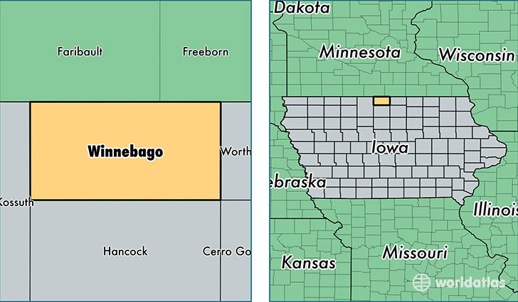
Winnebago County is a county equivalent area found in Iowa, USA. The county government of Winnebago is found in the county seat of Forest City.
With a total 1,040.44 sq. km of land and water area, Winnebago County, Iowa is the 2598th largest county equivalent area in the United States. Home to 10,559 people, Winnebago County has a total 5164 households earning 45603 on average per year.
Winnebago County, Iowa - Quick Facts
| FIPS Code | 19189 |
| Area Codes | 641 |
| Time Zone | CST |
| Major Cities | Forest City (population: 5,711), Lake Mills (population: 2,828), Buffalo Center (population: 1,447), Thompson (population: 756), Leland (population: 573), Scarville (population: 261), Rake (population: 243) |
| Land Area | 4,077 sq miles |
| Water Area | 400 sq miles |
| Household Income | $45,603 |
| Housing Units | 5,164 |
| Median Home Value | $91,900 |
| High School Grads | 92% of population |
| Holders of Bachelors Degrees | 19% of population |
| Retail Spending | $10,672 per capita |
| Food & Accomodation Sales | $6,386 per capita |
This page was last updated on June 30, 2016.