Where is Crawford County, Georgia?
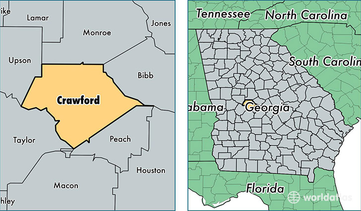
Crawford County is a county equivalent area found in Georgia, USA. The county government of Crawford is found in the county seat of Knoxville.
With a total 845.51 sq. km of land and water area, Crawford County, Georgia is the 2794th largest county equivalent area in the United States. Home to 12,387 people, Crawford County has a total 5216 households earning 41586 on average per year.
Crawford County, Georgia - Quick Facts
| FIPS Code | 13079 |
| Area Codes | 478 |
| Time Zone | EST |
| Major Cities | Roberta (population: 3,557), Musella (population: 1,145), Knoxville (population: 962) |
| Land Area | 4,783 sq miles |
| Water Area | 325 sq miles |
| Household Income | $41,586 |
| Housing Units | 5,216 |
| Median Home Value | $90,800 |
| High School Grads | 79% of population |
| Holders of Bachelors Degrees | 13% of population |
| Retail Spending | $1,451 per capita |
| Food & Accomodation Sales | $1,372 per capita |
This page was last updated on June 30, 2016.