Where is Cheyenne County, Colorado?
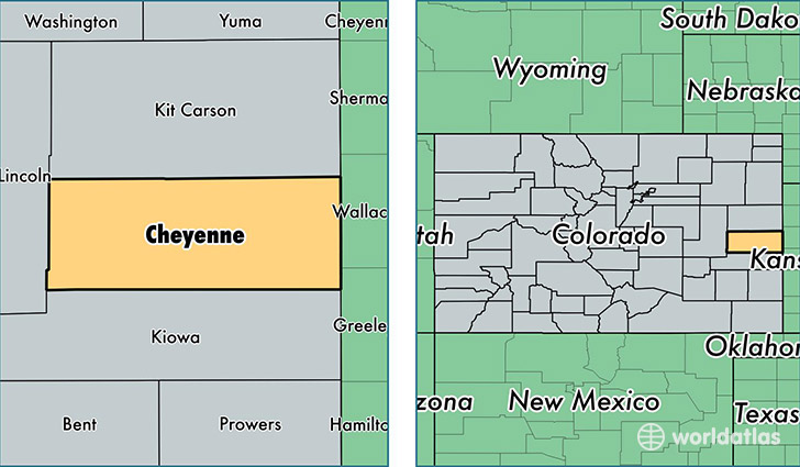
Cheyenne County is a county equivalent area found in Colorado, USA. The county government of Cheyenne is found in the county seat of Cheyenne Wells.
With a total 4,613.88 sq. km of land and water area, Cheyenne County, Colorado is the 375th largest county equivalent area in the United States. Home to 1,871 people, Cheyenne County has a total 963 households earning 51641 on average per year.
Cheyenne County, Colorado - Quick Facts
| FIPS Code | 8017 |
| Area Codes | 719 |
| Time Zone | MST |
| Major Cities | Cheyenne Wells (population: 1,150), Kit Carson (population: 430), Arapahoe (population: 242), Wild Horse (population: 31) |
| Land Area | 722 sq miles |
| Water Area | 1,778 sq miles |
| Household Income | $51,641 |
| Housing Units | 963 |
| Median Home Value | $81,700 |
| High School Grads | 87% of population |
| Holders of Bachelors Degrees | 21% of population |
| Retail Spending | $7,276 per capita |
| Food & Accomodation Sales | $407 per capita |
This page was last updated on June 30, 2016.