Where is Imperial County, California?
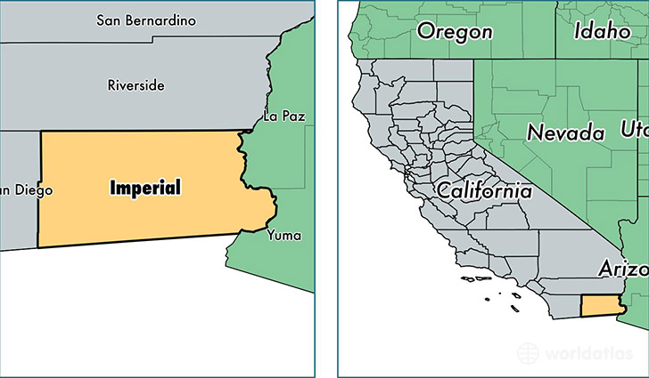
Imperial County is a county equivalent area found in California, USA. The county government of Imperial is found in the county seat of El Centro.
With a total 11,607.59 sq. km of land and water area, Imperial County, California is the 109th largest county equivalent area in the United States. Home to 179,091 people, Imperial County has a total 56485 households earning 41807 on average per year.
Imperial County, California - Quick Facts
| FIPS Code | 6025 |
| Area Codes | 760 |
| Time Zone | PST |
| Major Cities | El Centro (population: 48,695), Calexico (population: 39,614), Brawley (population: 26,597), Imperial (population: 21,882), Holtville (population: 8,399), Calipatria (population: 8,211), Heber (population: 7,435), Winterhaven (population: 3,201), Westmorland (population: 2,465), Niland (population: 2,358) |
| Land Area | 69,147 sq miles |
| Water Area | 4,176 sq miles |
| Household Income | $41,807 |
| Housing Units | 56,485 |
| Median Home Value | $147,300 |
| High School Grads | 65% of population |
| Holders of Bachelors Degrees | 13% of population |
| Retail Spending | $10,771 per capita |
| Food & Accomodation Sales | $167,799 per capita |
This page was last updated on June 30, 2016.