Administrative region of Samara Oblast, Russia
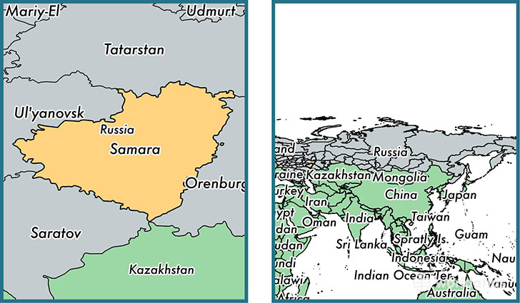
Samara Oblast is a administrative region found in the nation of Russia. Home to 3,239,737 people, it is the 12th largest division in Russia in terms of population.
Samara Oblast gained its current status as a administrative region in the year 1928. The government of Samara Oblast is lead by Nikolay Merkushkinand is based in the administrative region capital of Samara (Population: 1,134,730).
The most populous cities in Samara Oblast are: Samara (Population: 1,134,730), Tol'yatti (Population: 702,879), Syzran' (Population: 189,338), Novokuybyshevsk (Population: 111,800), Chapayevsk (Population: 70,147).
Samara Oblast Administrative region - Quick Facts
| Country | Russia |
| Region Type | Administrative region |
| ISO Code | RU_SAM |
| Time Zone | MSK |
| Year of Establishment | 1928 |
| Capital | Samara (Population: 1,134,730) |
| Head of Government | Nikolay Merkushkin |
| Total Population | 3,239,737 |
| Total Area | 53,600 sq km (20,695 sq miles) |
| Population Density | 60.4 sq km (156.5 sq miles) |
This page was last updated on July 24, 2015.