The Araguaia River
5. Description
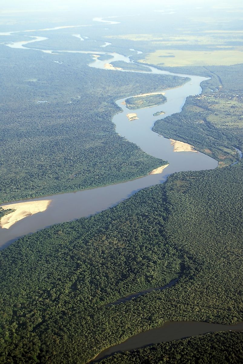
The 2,627-kilometer long Araguaia River is one of the major rivers of Brazil. It arises near the Brazilian town of Alto Araguaia in the eastern Mato Grosso state of Brazil in the Brazilian Highlands, and joins the Tocantins River at São João do Araguaia. Though the Araguaia is treated as a tributary of the Tocantins, it is almost equal in volume to the latter at the confluence of both the rivers. At one point in its mid-course, the Araguaia splits into a fork enclosing the 320-kilometer long Bananal Island, which houses the National Park of Araguaia.
4. Historical Role
The name of the Araguaia River means the "river of red macaws" in the local Tupi language. Since a long time ago, the river basin has been inhabited by the native South American peoples. In 1897, the French geographer and explorer Henri Coudreau partly explored the length of the river. On December 31st, 1959, the Araguaia National Park was established on the Bananal Island to protect and preserve the native flora and fauna of the region. Between 1972 and 1974, the Araguaia River also bore witness to the conflict between Left wing guerrilla forces and the armed forces loyal to the then-ruling military dictator of the country of Brazil, Emilio Médici.
3. Modern Significance
A number of protected parks, like the Emas National Park and the Araguaia National Park, exist along the course of the Araguaia River. These parks manage to draw a large number of tourists to Brazil each year, benefiting the local economies of the region. Though the presence of numerous falls and rapids allow only certain sections of the river to be used for navigation, the river has great potential to be utilized for generating hydroelectric power. It is also estimated that there are vast mineral deposits of copper, uranium, zinc, and even diamonds in the upper course of this river, an area which, as of yet, is still largely unexploited. The river also forms the natural boundary between the Brazilian states of Pará and Tocantins.
2. Habitat
The Araguaia National Park lies in the transition zone between the dense Amazon rainforests to the north and the grassland and stunted woodland ecosystems to the south. The area's vegetation is characterized by deciduous forests and savanna grasslands. The topography of the park is generally flat, with frequent flooding by the waters of the Araguaia occurring as a result. The months from September to October are the hottest, while rainfall is most frequent between November and March. The fauna of the Araguaia National Park is comprised by a large diversity of mammals, including the Giant anteaters, capybaras, jaguars, Maned wolves, and Giant otters, as well as such aquatic mammals as the Amazon River dolphin. Over 700 bird species are found in this ecosystem, including birds like the Common toucan, Musician wren, and Orinoco goose. Reptiles like the Black Caimans, Spectacled Caimans, turtles, and snakes, as well as a large diversity of amphibians, insects, and over 300 fish species, populate the forests and waters of this national park and its surrounding habitats. Recently, researchers have also discovered a new species of dolphins, the Inia araguaiaensis, in the Araguaia River. Since they estimate the current population of this newly discovered dolphin is around 1,000 individuals, they recommend the classification of this species to be under the "Vulnerable" category in the International Union for the Conservation of Nature's (IUCN) Red List of Threatened Species.
1. Threats and Disputes
The Araguaia River houses one of the most unique ecosystems of the world, and any threat to this river could lead to a collapse of this ecosystem, and cause the death of many of its endemic species, including the recently discovered Araguaia River dolphin. The rapid growth of population in the area is triggering massive deforestation, and the future possibility of a exploiting the land around the river for mineral mining continues to threaten the biodiversity of this pristine habitat. Damming of rivers also hampers the natural migration of the river's native fish species and its dolphins, impacting their life cycles and breeding patterns. Currently, the Brazilian government plans to construct 7 dams along the Araguaia River, and also to channelize and blast rock outcroppings along the river to create way for navigation along the river. Though these would likely benefit the national and regional economies, they could spell disaster for the flora and fauna inhabiting these riverine habitats.


