Purus River
The Purus River is a 3,211-kilometers-long river in South America that flows through the dense Amazon Forest and drains into the Amazon River. It has its headwaters in Peru’s Ucayali region and forms a part of the international boundary between Brazil and Peru. The river drains approximately 365,000 square kilometers, of which 90% of the drainage basin lies in the Acre and Amazonas states in Brazil. The Purus River is a highly meandering river with five “furos” (river channels) running parallel to each other. The river shares its name with Peru’s Purus Province, Purus District, and the Alto Purus National Park.
Geography

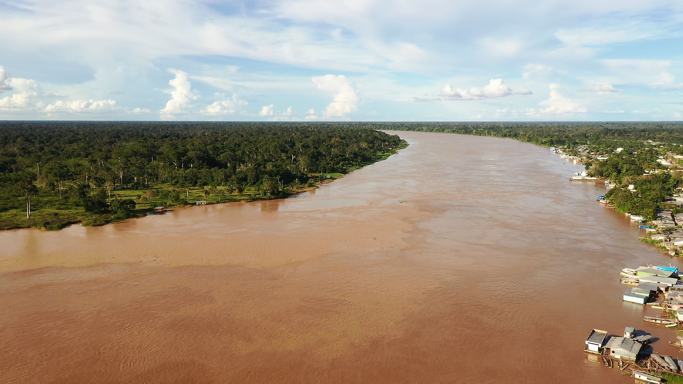
The Purus River Basin spans over 365,000 square kilometers and is located in the southwestern Amazon depression. The basin is shared by Brazil and Peru and is one of the most important watersheds of the Solimoes-Amazonas River. The wetlands cover approximately 40,000 square kilometers of the basin’s total area. The Purus River is the basin’s most outstanding hydrological feature and is one of the major tributaries of the Amazon River. The Purus, a highly meandering river, has huge floodplains and is flanked by numerous lakes near its shores.
The river’s headwaters arise from the Ucayali Basin at an elevation of 520 meters above sea level. It discharges an average of 10,970 cubic meters of water per second into the Amazon River. The river meanders for most parts of the journey from its source to the mouth. The straight-line distance is less than half of its total length. The Purus River covers a distance of 3,211 kilometers and has a uniform width for about half its length. The river floods from December to May.
Course

The Purus River’s headwaters rise on the hilly areas of the Ucayali Basin in the Amazon forest. The river has two main tributaries, Rio Curiuja and Rio Cujar, which both rise in the Purus Province, Peru, and confluence after crossing the Indian Reserva Indigena Mashco Piro. The headwaters are located about 320 kilometers from Cuzco. From the point of confluence, Purus meanders northeastwards to Brazil, then defines the Peru-Brazil border in the middle of Acre. The Purus receives the Santa Rosa River and stays on the border of the Santa Rosa do Purus National Forest for a short distance.

The Purus River continues its journey through the Amazon rainforest, flowing through a great depression separating the Ucayali and Madeira Rivers. It crosses into the Amazonas state and flows through Arapixi Extractive Reserve before forming the Purus National Forest’s west boundary. Then it runs past the towns of Pauini, Labrea, and Canutama, and the Piagacu-Purus Sustainable Development Reserve. Finally, it joins the Amazon River near Manaus.
Ecology
The Purus River has a rich biodiversity, comprising aquatic species and wild animals. Thus, the basin has large protected areas, including national parks, reserve areas, and national forests to protect the precious flora and fauna. The flooded forest and numerous floodplain lakes make the Purus River the second in fish productivity after the Amazon River. The Purus red howler is a species of howler monkey that is found in the forested areas along the river bank. Several species of birds visit and nest in the area, including egrets, blue herons, green parrots, and macaws. Reptiles like the Boa constrictors and water lizards are also common in the Purus Basin.