The Apurimac River
5. Description
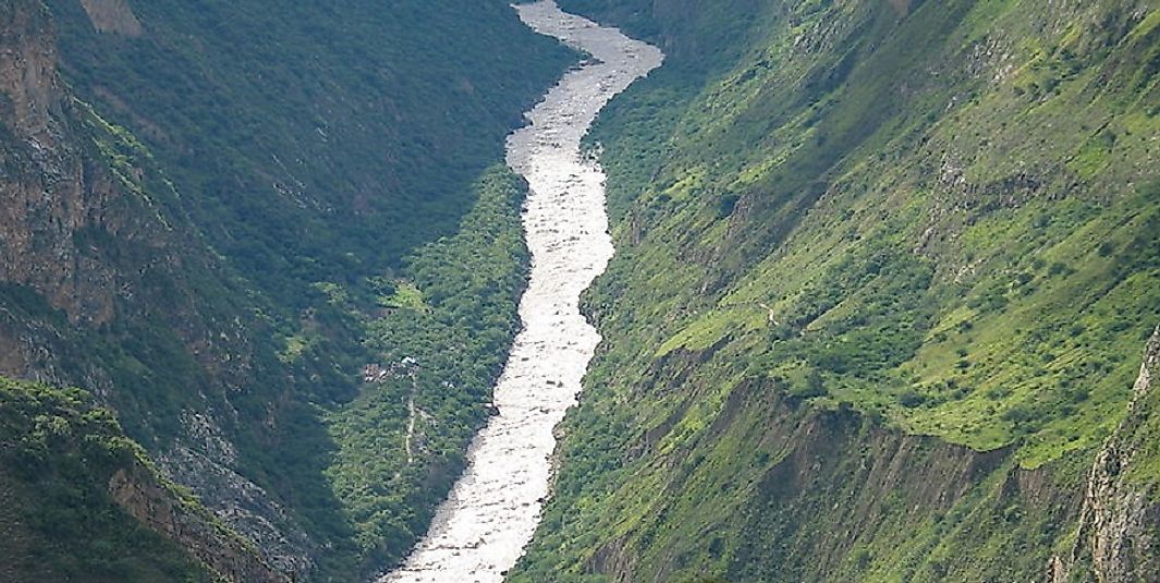
The Apurimac is a glacier-fed river flowing through southern Peru. It originates from a glacier on the ridges of Mount Mismi, the peak of which sits at roughly 18,000 feet above sea level, just near the Province of Apurimac. The Rio Apurimac also happens to be the source of the world’s largest river system, the Amazon. Initially, it descends as low as 860 feet at the point where its waters join with those of the River Ucayli, and these flow northwards for about 700 kilometers together before reaching their main confluence point. Due to its sharp drops in elevation over the challenging geographical and geological aspects along the way, with innumerable canyons and narrow points, the flow of the river is quite fast in comparison to most other major rivers from around the world.
4. Historical Role
The Apurimac River has played a significant role in benefiting the ecosystem all across the wide geographical boundaries of various countries of South America. Being a glacier river, it crosses most of the places along with River Ucayli at a good speed due to the torrential influences, which are responsible for its quick descent. The Apurimac River was later adjudged as being the source of the mighty Amazon during the 18th Century, where it and the River Ucayli is responsible for providing a definite reserve basin for the Amazon. Thus, this distinction as the Amazon's source was won for the Apurimace over the River Manaron, which was considered as the source initially.
3. Modern Significance
The Apurimac River is an important source of subsistence for the people living in southern Peru. The glacial river is in its complete and pure form when reaching its confluence with the Ucayli River. This in return helps in keeping the demand of water levels in check for daily life and agricultural needs in the basin. Apart from this, the greater Amazon Basin as a whole is significantly channeled to feed and keep the forest habitats intact, thanks in part to the ecologically significant, uninterrupted flow of the River Apurimac. The river is skillfully channeled by the effects of heavy rains, and numerous canals and the vessels that traverse them are benefited from these channels, helping them to avoid the threat of water logging at places.
2. Habitat
The River Apurimac, being a main part of the second largest river basin in the world, that of the Amazon, traverses through high valleys, canyons, forest ranges, and all manner of habitats. Thus, it forms a major reason for numerous drainage basins and minor canals which are dependent upon the overflow of the river to channel deep forest ranges. The Apurimac River is a pure freshwater source that provides sufficient water for these drainage basins during the heavy rain periods, where the waters may stay for quite a long duration of time thereafter. The waterside habitats are preserved in these forests and the food chain is maintained extensively thanks to this drainage pattern.
1. Threats and Disputes
The Apurimac River descends a great degree over its course and, just after descending, it meets the River Ucayli and at last it forms a major reason for the formation of the Amazon River. After meeting the Ucayli, the freshwater river slowly increases its volume and, during some monsoons, the drainage basins overflow, thereby flooding nearby places and forests in the Amazonian valleys. The support of the Peruvian Ministry of Environment with the assistance of the Ucayli Forest Information System has implemented agendas to create awareness by locals regarding such flooding, and channelize these rivers in such a way that few human lives and wild habitats are hampered as a result of the flooding which commonly occurs during the rainy seasons.


