Welland Canal
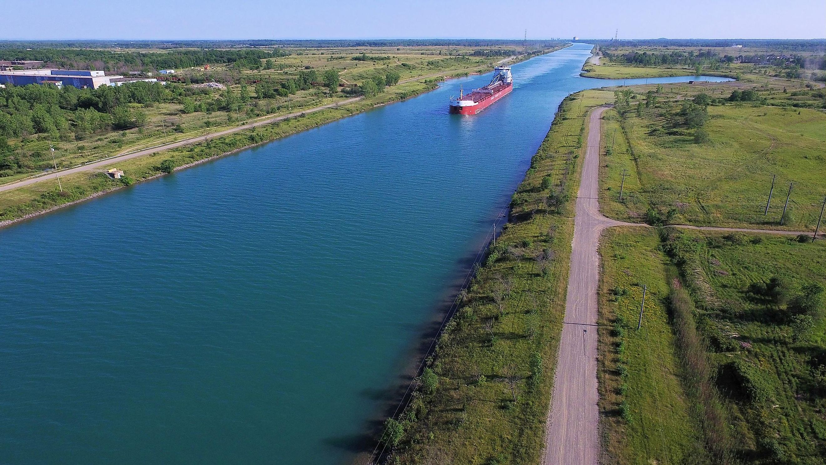
The Welland Canal is a waterway in Ontario, Canada linking Lake Erie to Lake Ontario. It is a key section of the Great Lakes Waterway and St. Lawrence Waterway, providing a deep draft passage between two of the Great Lakes. The canal serves about 3,000 ships, transporting 40 million tons of cargo annually. It contributed significantly to the growth of the city of Toronto, Canada's most populous city, and allows ships a route to bypass Niagara Falls. The current canal is the fourth one built on that location.
Geography

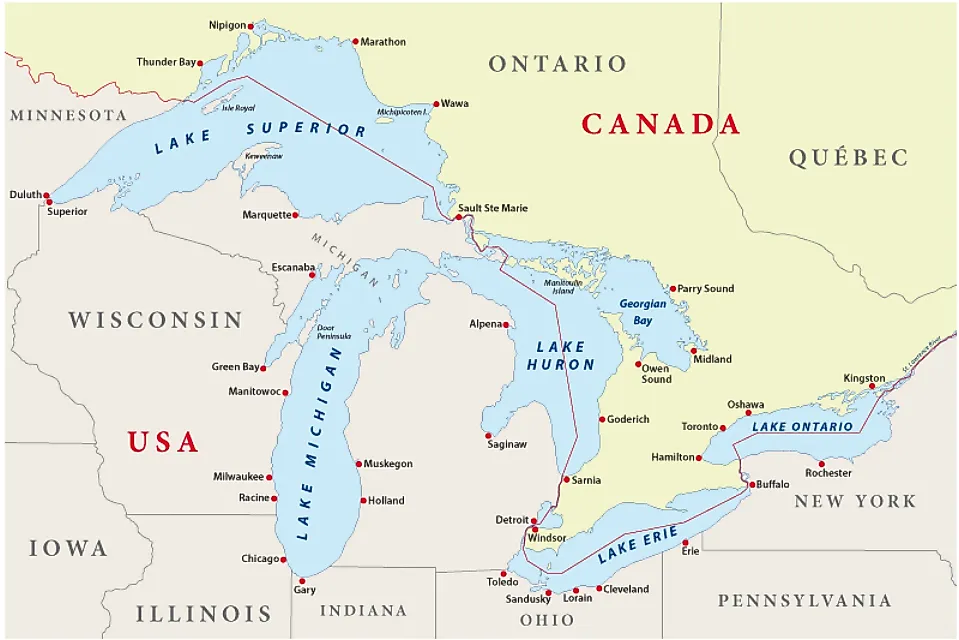
The current Welland Canal, also known as the Welland Ship Canal, is 7.6 m deep and about 43 km long, extending from Port Colborne in Lake Erie to Port Waller in Lake Ontario. It provides a more direct and shorter connection to Lake Erie than other canals such as the Erie Canal and Trent-Serven Waterway. The Welland Canal comprises eight ship locks, each 24.4 m wide. Seven locks, each 233.5 m long, are located at the Niagara Escarpment, while the eighth lock, known as the guard lock, is 349.9 m long.
The canal is crossed by tunnels, movable bridges, and the Garden City Skyway which allows only vessels with a maximum height of 35.5 m to use the canal. Also, only ships that are at most 225.6 m in length can sail through the Welland Canal. It takes a vessel about 11 hours to cross the canal from end to end. The ships can use the canal from late March to December and it is usually closed during the winter season because of the bad weather.
Brief History

Before the Welland Canal's construction, cargos were transported overland between Chippewa and Queenston on the Niagara River. In 1824, the province of Upper Canada (then a British colony) allowed for the formation of the Welland Canal Company to oversee the canal’s construction. The first Welland Canal's construction began in November 1824 and opened five years later in November 1829. In 1841, the canal company and Upper Canada began deepening the existing canal, completing the work in 1854. This enlarged canal was the second Welland Canal.
The third Welland Canal was much shorter and featured the Merritton Tunnel and 26 locks. However, the canal could still not accommodate many boats because of its size. The current canal’s construction was commissioned in 1913 but was abandoned between 1916 and 1919 due to labor force shortage during World War I. It was completed and inaugurated on August 6, 1932.
Accidents
Numerous accidents have occurred on the Welland Canal. In June 1912, the steamer ship La Canadienne developed a mechanical problem and rammed onto the third Welland Canal’s Lock 22, causing downstream flooding which killed three boys who were fishing in Lock 21. In August 1974, the Steelton ship knocked and destroyed Port Robinson Bridge 12, injuring the ship watchman and bridge master. In August 2001, another vessel, Windoc, struck Allanburg Bridge 11, leading to the total loss of the ship. Port Colborne Bridge 19 was also struck and destroyed by a ship in 2015. In July 2020, the Florence Spirit and Alanis cargo ships collided near Port Robinson, with no casualty or cargo spillage reported.