Frisian Islands
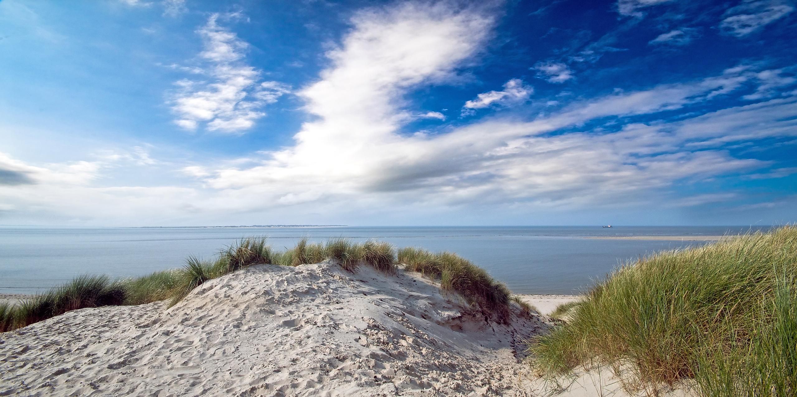
Often referred to as the Wadden Sea Islands, the Frisian Islands are a chain of low-lying islands that form an archipelago in the eastern margins of the North Sea and are positioned northwest of the European mainland.
The Frisian Islands cover a total area of about 1,047.49 km2. These islands extend from the northwestern part of the Netherlands, along the northern part of Germany, and end at the southwestern coast of Denmark. Due to their strategic location, these islands protect the Wadden Sea’s mudflat region from the North Sea. The Frisian Islands are further subdivided into the North, East, and West Frisian Islands.

The North Frisian Islands
These Islands are located in the northernmost part of the German region of Frisia and are divided between Denmark and Germany. A total of 14 islands comprising of 4 large islands and 10 small islets form a part of the North Frisian Islands. These islands are administered under the northernmost German state of Schleswig-Holstein as a part of the Nordfriesland district. The four large islands are Sylt, Amrum, Föhr and Pellworm. The 10 small islets are referred to as Halligen. Covering an area of 100 km2, the island of Sylt is the largest among all the North Frisian Islands. Sylt is noted for its beautiful beaches and tourist resorts and is connected to the mainland via the Hindenburgdamm causeway.
The Danish Wadden Islands are situated to the north of the North Frisian Islands. These include the inhabited islands of Rømø, Mandø, and Fanø as well as the uninhabited islets of Langli and Koresand.
The East Frisian Islands
This chain of islands stretches from the Ems River estuary to the Jade Channel and is administered by Germany. A total of 12 islands are a part of the East Frisian Islands. Covering an area of 30.74 km2, the island of Borkum is the largest among all the East Frisian Islands. The other islands are Juist, Norderney, Baltrum, Langeoog, Spiekeroog, Wangerooge, Lütje Hörn, Memmert, Kachelotplate, Minsener Oog, and Mellum. Extensive mudflats that are colloquially known as Watten are situated between the mainland and the islands. Numerous tourists visit the main islands during the summer season and the towns of Norderney and Borkum serve as the most popular resort areas.

The West Frisian Islands
A total of 14 islands forms a part of the West Frisian Islands and are administered by the Netherlands. Covering a total area of 463.16 km2, the island of Texel is the largest and the most populous among all the Frisian Islands. The other islands are Ameland, Engelsmanplaat, Griend, Noorderhaaks, Rif, Richel, Rottumeroog, Rottumerplaat, Schiermonnikoog, Simonszand, Terschelling, Vlieland and Zuiderduintjes.
Formation Of The Frisian Islands

The Frisian Islands were formed as a result of deglaciation during the planet’s last glacial period. About 7,000 years ago during the start of the Holocene era, the current North Sea area was submerged due to the rising sea levels. Large amounts of sand were deposited by tidal action along the seashores, creating sand dunes. The powerful sea waves eventually broke these dunes apart and resulted in the formation of the Wadden Islands and their tidal mudflats. With time, the growth of plants on the island led to the subsequent stabilization of the land.
It has been observed that the Frisian Islands have been constantly undergoing slow "migrating" movement. As a result of this, the islands in the western part have started to disappear whereas the islands in the eastern part have grown in size.
Wildlife And Human Settlement

Humans have inhabited the Frisian Island for several years. The people who inhabit these islands are referred to as Frisians after the German region of Frisia. Frisian is also a minority language spoken by about 10,000 people in this region of Germany. The mudflats of the islands contain many aquatic species like crabs, oysters, flatfish, mussels, and worms. About 12 million birds including 34 species of migratory birds are also found here.
The area that surrounds these islands serve as a popular navigational passage and have also been widely explored for petroleum and natural gas. However, all these activities pose a serious threat to the region’s extremely fragile biosphere. To protect the flora and fauna of the region, the majority of Frisian Islands are protected under an International Wildlife Reserve, which is maintained by the countries of Denmark, Germany, and the Netherlands.


