Balearic Islands
Although Spain is located largely on the Iberian Peninsula, it also possesses numerous islands in the World's Oceans and seas. Some islands are located in the same area, forming an archipelago or island chain. The Balearic Island group is one of Spain's archipelagos in the Mediterranean Sea. Mallorca, Spain’s largest island, is part of the Balearic archipelago. Some of its islands are popular tourist destinations, known internationally as party destinations.
Contents
Where Are The Balearic Islands?

The Balearic Islands are located in the Western Mediterranean Sea, near the Iberian Peninsula’s eastern coast. The archipelago is approximately 80-300 km off Spain's coast, with Valencia being the closest municipality on the mainland. It is bounded to the south by continental Africa, north by Catalonia, and by Sardinia Island to the east. The Balearic Sea separates the island group from mainland Spain. Mallorca, the largest island in the archipelago, is located almost halfway between Ibiza (southwest) and Menorca (northeast). The archipelago is a Spanish province and an autonomous community.
Geography

The Balearic Archipelago comprises four major islands and several other islets in the Mediterranean Sea. It covers approximately 4,992 km2, accounting for only 1% of the Spanish territory. The islands are grouped further into two groups, the Gymnesian Islands (comprising Cabrera, Menorca, and Mallorca) and Pityusic Islands (Formentera and Ibiza). Most of the minor islands and islets are located close to the bigger islands.
The Balearic Islands are an extension of the Iberian Peninsula’s sub-Baetic cordillera, with a sill close to Cape Nao of Alicante Province linking the two. The islands are of varied terrains, characterized by lowlands, plateaus, and undulating hills. Until the 19th century, the archipelago’s coastal areas did not have large settlements because of numerous raids by the Barbary pirates. However, these areas now host some of the biggest cities on the archipelago today.
Islands

The archipelago comprises four major islands are Mallorca, Menorca, Ibiza, and Formentera. The most popular minor island is Cabrera because of the Cabrera Archipelago Maritime-Terrestrial National Park on the island. Other minor islands include Es Vedrà, Es Conills, Tagomago, Sa Conillera, Colom, Na Redona, and Ses Bledes.
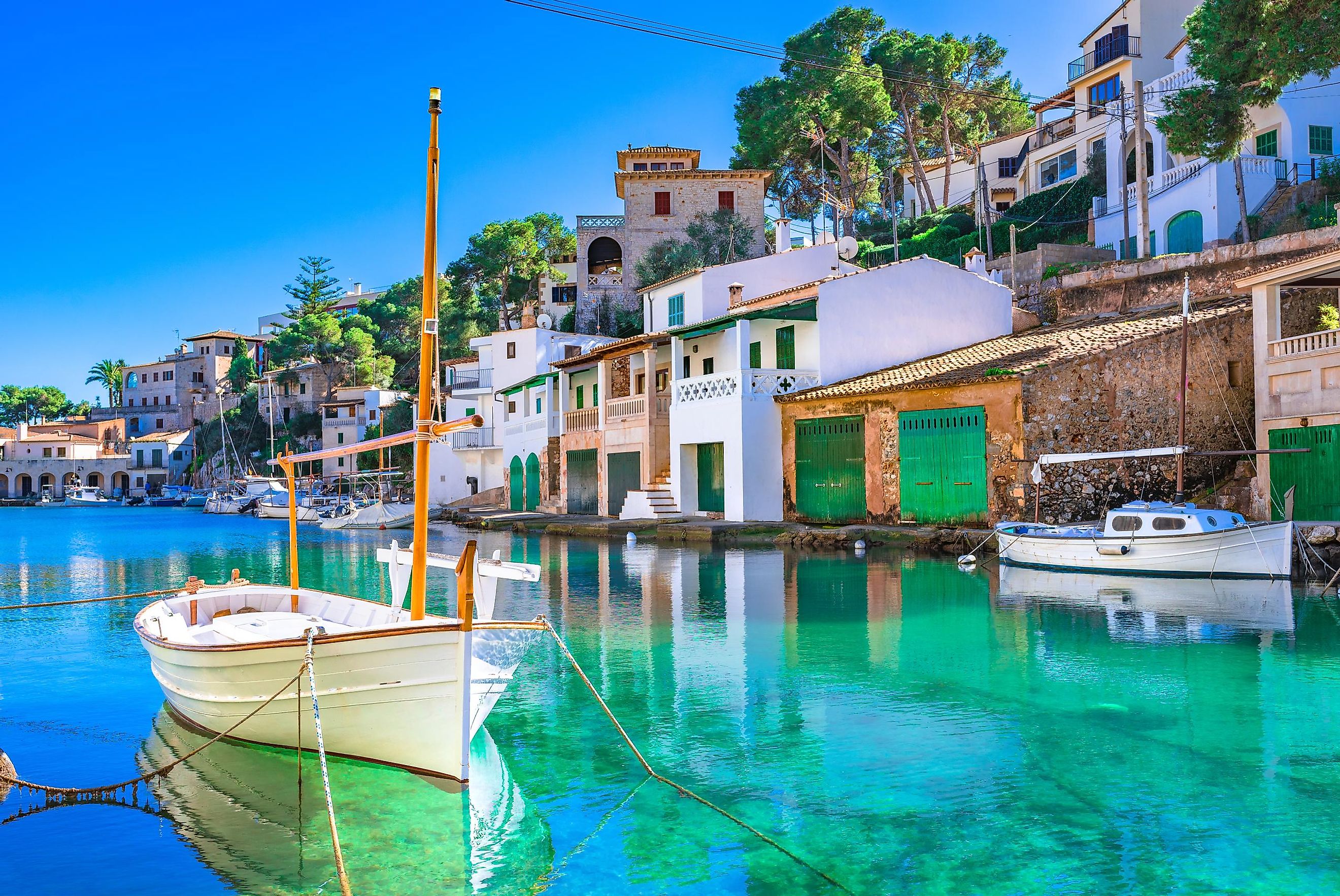
Mallorca (also spelled Majorca) is the largest island on the archipelago, spanning 3,640 km2. It is bordered to the northeast by Menorca, southwest by Ibiza, southeast by Cabrera Island, and west by Dragonera. Palma, Mallorca’s capital, is also the Balearic Islands autonomous community’s capital. The island is home to about 897,000 people and has a population density of 246 people per km2, making it one of Spain’s most crowded places.
Menorca (also spelled Minorca), located northeast of Mallorca, is the second-largest island in the Balearic Archipelago, covering 696 km2. Its capital and largest city, Mahón, is located on the eastern side. Menorca’s population is approximately 93,397. Its location in the middle of the western Mediterranean Sea means that it has long been a meeting place between different cultures.
Ibiza, located southwest of Mallorca, spans 572 km in the Mediterranean Sea. It the closest island to mainland Spain at about 150 km from Valencia. About 148,000 people live on the island, with Ibiza Town as the largest settlement.
Formentera Island is the smallest of the four major Balearic Islands. It covers an estimated area of 83.2 km2 and is 9 km long. The island is located about 6 km south of Ibiza. Its population is about 12,000 people.
Climate
The Balearic Islands experience a Mediterranean climate because of their location in the western Mediterranean Sea. This climate is characterized by mild, wet winters and warm, dry summers. During summer, the sub-tropical ridge often influences the region’s climate by keeping the atmospheric conditions dry. In winter, the subtropical ridge moves towards the equator, leading to frequent rainfall. Thus, the islands receive most of their rainfall during spring and winter. The temperature ranges from 15 °C (59.7 °F) in January to 30 °C (85.6 °F) in August. The average temperature is 21.8 °C (71 °F), while the average annual precipitation 450 mm.
Brief History

According to legends, the Greeks referred to the islands as Gymnesiae because the islands’ inhabitants were always naked during summer seasons. Other legends from Ancient Greece suggested the inhabitants lived in caves and hollow rocks. They also, so the stories go, had a deep love for their women and would give ransoms of up to four men for just one woman. Throughout their history, the islands were under the rule of the Carthaginians, Romans, Phoenicians, and Byzantines, and occasionally were self-ruling.
In the 800s and 900s, pirates used some of the islands to hide and steal from fleets, forcing the Emirate of Córdoba to take control of the islands and make them part of the state’s territory. However, piracy did not cease. In 1113, the Republic of Pisa led a crusade to the island, which included over 400 ships. The Crusaders defeated the Balearics and conquered Palma, ending its period of sea dominance. After the islands were under the control of the Berbers for a time, King James I of Aragon recaptured Palma in 1229.
Menorca became a British dependency in the 18th century after the Treaty of Utrecht was signed between Portugal, Spain, and Great Britain. In 1756, the French conquered the island, which they retained for the duration of the Seven Years' War. The British got it back after the war, but their rule over it would be short-lived. It was returned to Spain following the signing of the Treaty of Amiens in March 1802.
Human Settlement

The four main islands and the surrounding islets and minor islands are administered as insular councils. Only the Mallorca insular council is further subdivided into six comarques, while the other three insular councils also serve as separate comarques. Each of the nine comarques is further subdivided into municipalities, which are again divided into civic parishes.
The Balearic archipelago’s population has been growing steadily since the turn of the 20th century. According to a 2017 estimate, the islands have a combined population of 1.15 million people, of which the majority (approx. 80%) live on Mallorca. Ibiza is the second-most populous island with 111,000 people, while Menorca has 87,000 people. Formentera is the least populated island, with close to 8,000 people. Palma, on Mallorca, is the largest city in the archipelago with about 410,000 people.
Wildlife
The Balearic Islands’ flora and fauna are typical of the Mediterranean, with many endemic species. The ecosystem comprises salt meadows, gorges, mountainous areas, and cliffs, where plant and animal species live. There are more than 400 fish species and hundreds of invertebrates, birds, and crustaceans living on and around the islands. The seagrass on the seabed forms a meadow which is an important food and protects numerous species. This plant is also responsible for the sea’s clear water.
On land, there are 124 endemic plant species, 31 orchids, 32 ferns, and some introduced plant species. Also, there are over 300 endemic animals, most of which are snails and insects. Some of the animal species include the Lilford's wall lizard, Majorcan midwife toad, Balearic shearwater, Balearic warbler, and Eurasian blue tit.


