What Is Cartography?
Cartography is the science and art of map-making. This field of study deals with the conception, production, and study of maps and charts. Cartography and Geography are two closely related fields of study, each dependent on the other for correctly describing a place on our planet. Both the disciplines together make it easy for us to understand the world in which we live, our positions on the Earth, and the way life functions here.
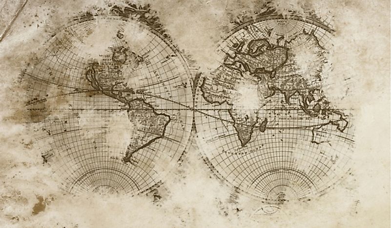
The History Of Cartography
The history of cartography goes much further back in history than the time when the subject was designated by a name and a definition. Several prehistoric cave paintings have been recorded as time-worn maps, and artifacts have been preserved hoping that they bear evidence to the location of lost cities, towns, and treasure deposits of the ancient world. A wall painting, dated to the 7th Millennium BC, might be one of the oldest maps in the world. This painting is believed to represent the location of Çatalhöyük, a city in ancient Anatolia.
The modern form of cartography started to develop from the 6th Century BC onward. Ancient Greeks and Romans served as pioneers in this development. The contributions of Anaximander, a Greek philosopher, and Ptolemy, a multi-talented Greek genius, are most notable in this regard. The former was credited with the production of the first documented map of the world while the latter produced Geographia, a treatise on Cartography. Soon, by the 8th Century, Arabic translations of cartographic work by the Greeks were being made by the Arabian scholars. In 1154, the Arabic scholar, Muhammad al-Idrisi prepared a medieval atlas incorporating knowledge of the world gathered by Arabic merchants.
Further east, the ancient and thriving civilizations of India and China also produced stalwarts in the field of ancient cartography. Indian astronomers and cartographers had already started mapping the Pole Star and other constellations using age-old mapping systems. The State of Qin in China is associated with the production of some of the oldest extant maps of the world, some dating as far back as the 5th Century BC.
Such inventions as the telescope, the compass, and the sextant soon came to revolutionize the world of cartography. It triggered the Age of Exploration from the 15th Century through the 17th Century. During this time, the European cartographers conducted extensive surveys, explored unexplored lands, and created detailed maps, representing the entire world on small pieces of paper. The world’s oldest extant globe was produced in 1492 by the German cartographer Martin Behaim. Soon, more inventions, discoveries, and explorations gave rise to the modern forms of cartography, the science and art of map-making.
General Vs Thematic Cartography
Two broad categories, general cartography and thematic cartography, constitute the larger field of cartography. That said, you may be wondering what is the difference between these two fields of cartography?
- General Cartography: This cartographic realm involves the production of maps that are meant for a general audience and covers varied aspects related to location and reference systems. Such maps are often produced in series. Examples include a full series of 1:24,000 scale topographic maps produced by the US Geological Survey, and 1:50,000 "Ordnance Survey" maps representing the United Kingdom produced by the Government of Great Britain.
- Thematic Cartography: This field of cartography deals with the production of thematic maps based on specific geographic themes, and is usually targeted at specific audiences. The higher volumes of geographic information available in the modern day has encouraged the rapid growth of Thematic Cartography. Examples may include a dotted map exhibiting rice cultivation in the Indian state of Uttar Pradesh or a shaded or patterned map exhibiting demographic information (such as the population density) of the counties in Texas.
What Is A Map Projection?
Map projection is the systematic representation of the Earth or a part of the Earth with its meridians and parallels upon a flat surface. Map projections are associated with various forms of distortions. Only a globe can represent areas and shapes with accuracy. Different types of map projections have been devised to overcome the various types of distortions.
Classes Of Map Projections
Listed below are the major classes of map projections.
- Cylindrical Projections: Here, the Earth is treated as a cylinder with horizontal parallels and vertical meridians. The Mercator Projection is one example of the cylindrical type of projection.
- Pseudo-cylindrical Projections: Here, the parallels and the central meridian are mapped as straight lines while the other meridians are regularly spaced curved lines.
- Conic Projections: Conic projections map parallels as arcs of circles and meridians as straight lines.
- Pseudoconical Projections: In pseudo-conical projections, all meridians except the central meridian (which is represented as a straight line) are represented as complex arcs. The parallels are in the form of circular arcs.
- Azimuthal Projection: Here, parallels are in the form of full, concentric circles while meridians are in the form of straight lines.
- Pseudoazimuthal Projection: In this type of map projection, the equator, and the central meridian intersect each other as straight, perpendicular lines. The rest of the parallels are in the form of complex curves that bow away from the equator. Similarly, the other meridians are mapped as complex curves bowing in towards the central meridian.
Topographical Maps Vs Topological Maps
- Topographical Map: This type of map exhibits a highly detailed, and quantitative, representation of the relief of an area. Contour lines (lines that connect places with the same elevation) are often used for this purpose. Topographic maps are usually available in the form of a series of maps where two or more map sheets together represent the complete topographical information. Drainage patterns, ground relief, forest cover, man-made features such as roads and railways are some of the features represented by topographical maps.
- Topological Map: These maps are either highly simplified maps of places or diagrams that represent only the necessary or required information regarding a location. Such maps do not adhere to scale and directions, and distances might vary. The London Underground's tube map or the subway system route map of the Toronto Subway would be good examples of topological maps.