Maps of French Guiana

Covering an area of 83,534 sq. km, French Guiana is located on the northeastern edge of South America. French Guiana is not an independent nation but rather an overseas possession of the French. Its relatively large land area actually makes it France’s 2nd largest region. French Guiana shares a border with both Brazil to the south and east and with Suriname to the west.
Thick rainforests blanket most of the nation. The south in particular is nearly impenetrable thanks to the inhospitable environment that the rainforests create. Hot, wet, and filled with dangerous animals, most of French Guiana's population can be found living along the coastline. A narrow coastal strip fronts the Atlantic Ocean coastline of French Guiana. To the south, the land is an unsettled wilderness, covered by a dense jungle and parts of the Amazon Rain Forest, that is dissected by dozens and dozens of rivers. Offshore islands include Iles du Salut (and Devil's Island).
Rivers dissect French Guinea into many different areas and regions. Many of these rivers flow north from the southern mountains. The major ones include the Maroni and Lawa, forming its (disputed) border with Suriname; the Oyapok, forming a long natural border with Brazil, and the Approuaque, Camopi, Mana, and Tompok Rivers. The Barrage de Petit-Saut hydroelectric dam in the far north eventually formed a large artificial lake to the northeast of St Elie.
The Tumac-Humac Mountains can be found in the south forming a natural border with Brazil. The land slowly begins to rise in the central regions of the country. The highest point in French Guiana, as marked by an upright yellow triangle is, Bellevue de l’lnini, which rises to an elevation of 2,792 ft. (851m). The lowest point is the Atlantic Ocean (0m).
Administrative Map of French Guiana

French Guiana - an overseas region and department of France is, divided into two arrondissements, 19 cantons and a total of 22 communes (towns and villages). Cayenne and Saint-Laurent Du Maroni are the two arrondissements. Saint-Laurent Du Maroni has 8 communes and Cayenne has 14 communes.
Covering an area of 83,534 sq. km, French Guiana is France’s 2nd largest region. Located in the northwestern corner of the Island of Cayenne at the Cayenne River Estuary is Cayenne – the capital (prefecture) city of French Guiana.
Location Map of French Guiana

French Guiana is an overseas region and department of France that is located in the northeastern edge of South America. It is geographically positioned in the Northern and Western hemispheres of the Earth. French Guiana is bordered by Brazil in the east and south; by Suriname in the west and by the Atlantic Ocean in the northeast.
Regional Maps: Map of South America
Outline Map of French Guiana

The above blank map represents French Guiana - an overseas region and department of France, located in the northeastern edge of South America. The above map can be downloaded, printed and used for geography education purposes like map-pointing and coloring activities.

The above outline map represents French Guiana - an overseas region and department of France, located in the northeastern edge of South America. It is France’s 2nd largest region.
Key Facts
| Legal Name | |
|---|---|
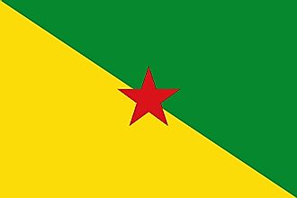
| Flag |
|
This page was last updated on December 16, 2023