Maps of Niue

Covering a land area of 261 sq.km (100.95 sq mi), Niue is an island country and a raised coral atoll located in the southwestern Pacific Ocean. Niue is one of the world's largest coral islands. It consists of steep limestone cliffs lying along the coast, giving way to a central plateau. Two large bays indent the western coast, with Alofi Bay in the center and Avatele Bay in the south. Limestone caves are common close to the coast, and a coral reef almost completely surrounds the island--with the only major break being on the western side, close to Alofi. The highest point is an unnamed elevation near the Mutalau settlement, and it peaks at 223 ft. (68 m). The lowest point is the Pacific Ocean (0m).
Political Map of Niue

Niue is divided into 14 villages (municipalities). The villages are: Makefu, Tuapa, Namukulu, Hikutavake, Toi, Mutalau, Lakepa, Liku, Hakupu, Vaiea, Avatele, Tamakautoga, Alofi South and Alofi North.
Covering a land area of 261 sq.km, Niue is an island country and one of the world’s largest coral atolls in the southwestern Pacific Ocean. It is a self-governing state in free association with New Zealand. Located on the western coast of the island at the heart of the Alofi Bay is, Alofi – the capital and the largest village of Niue. The villages of Alofi North and Alofi South together functions as the capital of Niue. Alofi is also the administrative, industrial and financial center of the country.
Where is Niue?

Niue is an island nation and a raised coral atoll located in the southwestern Pacific Ocean. It is geographically positioned both in the Western and Southern hemispheres of the Earth. Niue is situated between Tonga, Samoa and Cook Islands. It is located to the northeast of Auckland (New Zealand) and to the east of the Vava’u Group of Tonga.
Regional Maps: Map of
Outline Map of Niue

The above blank map represents Niue -an island country and one of the world’s largest coral atolls in the southwestern Pacific Ocean. The above map can be downloaded, printed and used for geography education purposes like map-pointing and coloring activities.

The above outline map represents Niue - an island country and one of the world’s largest coral atolls in the southwestern Pacific Ocean. Niue is a raised coral island that is roughly oval in shape. It is sometimes called “The Rock of Polynesia” or simply “The Rock”.
Key Facts
| Legal Name | Niue |
|---|---|
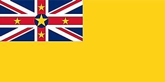
| Flag |
|
| Capital City | Alofi |
| 19 01 S, 169 55 W | |
| Total Area | 260.00 km2 |
| Land Area | 260.00 km2 |
| Water Area | N/A |
| Population | 1,618 |
| Currency | New Zealand dollars (NZD) |
This page was last updated on February 25, 2021