Maps of Montserrat

Montserrat is a British Overseas Territory and a part of the Leeward Islands chain in the Caribbean. It has an area of 102 sq. km (39 sq mi). This mountainous, pear-shaped island is currently increasing in size because of the build up of volcanic deposits on the southeast coast.
The island is measured at 16km (10 miles) long and 11km (7 miles) wide, with rock cliffs rising 15 to 30 m (50-100ft) above the sea and smooth bottomed sandy beaches scattered among coves on the west ( Caribbean) side of the island.
The island's highest point is located in the Soufriere Hills, but a definitive height is unavailable due to the consistent eruptions of the volcano. Scattered small streams drains the northern reaches of the island.
Parishes of Montserrat Map

Montserrat is divided into 3 parishes. The parishes are: Saint Anthony, Saint Georges and Saint Peter.
Located on the south western coast of the island was Plymouth – the capital and the only port of the island country. The volcanic eruptions led to the complete destruction of the entire city and hence the administrative capital was relocated to Brades – the newly-built capital and the largest city of Montserrat; located in the north western part of the island.
Where is Montserrat?

Montserrat is a British Overseas Territory and a part of the Leeward Islands chain in the Caribbean. It is positioned both in the Northern and Western hemispheres of the Earth. Montserrat is situated in the southwest of Antigua; in the southeast of Redonda and the northwest of Guadeloupe. The island of Montserrat is surrounded by the Caribbean Sea and the Atlantic Ocean.
Regional Maps: Map of North America
Outline Map of Montserrat

The above blank map represents Montserrat – a British Overseas island territory in the Caribbean. The above map can be downloaded, printed and used for educational purpose like map-pointing activities, etc.

The above outline map represents Montserrat, a British Overseas territory in the Caribbean. This mountainous pear-shaped island is also famously known as the “Emerald Isle of the Caribbean”.
Key Facts
| Legal Name | Montserrat |
|---|---|
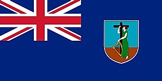
| Flag |
|
| Capital City | Plymouth; note - Plymouth was abandoned in 1997 because of volcanic activity; interim government buildings have been built at Brades Estate, the de facto capital, in the Carr's Bay/Little Bay vicinity at the northwest end of Montserrat |
| 16 42 N, 62 13 W | |
| Total Area | 102.00 km2 |
| Land Area | 102.00 km2 |
| Water Area | N/A |
| Population | 5,315 |
| Currency | East Caribbean dollars (XCD) |
This page was last updated on February 25, 2021