Maps of Anguilla

Ringed by coral reefs and white sand beaches, Anguilla (a British Overseas Territory), is a mostly flat, low-lying island of coral and limestone; located in the north-eastern Caribbean Sea, east of Puerto Rico and US Virgin Islands.
As observed on the physical map of Anguilla above, there are no permanent rivers or streams on the island, and the name of the island is derived from its long thin shape.
Anguilla's highest point is Crocus Hill, with an elevation of only 213ft above sea level. A yellow, upright triangle marks its position on the map.
Anguilla's territory includes a number of smaller offshore islands and cays, mostly tiny and uninhabited. The major ones include: Anguillita, Dog Island, Prickly Pear Cays, Sandy Island, Scrub Island, Little Scrub, Scilly Cay, Seal Island and Sombrero (also known as Hat Island).
Political Map of Anguilla

Anguilla has no administrative divisions. It is one of the British overseas territories in the Eastern Caribbean. Situated in the center of the island near the Crocus Hill is, The Valley, the capital and the largest city of Anguilla.
Where is Anguilla?

Anguilla is the northernmost of the Leeward Islands, located in the Eastern Caribbean. It is positioned in the Northern and Western hemispheres of the Earth. Anguilla lies few miles north of St. Martin and is surrounded by the Caribbean Sea and the Atlantic Ocean. It shares its maritime borders with Antigua, Barbados and the Virgin Islands of US.
Regional Maps: Map of North America
Outline Map of Anguilla

The above blank map represents Anguilla - the most northerly of the Leeward Islands located in the Caribbean. The above map can be downloaded, printed and used for geographical educational purposes.

The above outline map represents Anguilla - an island nation in the Lesser Antilles. Anguilla is a spectacular chain of flat, low-lying islands in the Caribbean Sea.
Key Facts
| Legal Name | Anguilla |
|---|---|
| Flag |
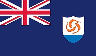
|
| Capital City | The Valley |
| 18 13 N, 63 03 W | |
| Total Area | 91.00 km2 |
| Land Area | 91.00 km2 |
| Water Area | N/A |
| Population | 17,422 |
| Currency | East Caribbean dollars (XCD) |
This page was last updated on February 25, 2021