Where is Ottawa County, Ohio?
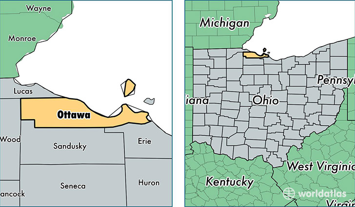
Ottawa County is a county equivalent area found in Ohio, USA. The county government of Ottawa is found in the county seat of Port Clinton.
With a total 1,515.31 sq. km of land and water area, Ottawa County, Ohio is the 1804th largest county equivalent area in the United States. Home to 41,154 people, Ottawa County has a total 27851 households earning 53202 on average per year.
Ottawa County, Ohio offers the following attraction to visitors: Perry's Victory & International Peace Memorial
Ottawa County, Ohio - Quick Facts
| FIPS Code | 39123 |
| Area Codes | 419 |
| Time Zone | EST |
| Major Cities | Port Clinton (population: 13,781), Oak Harbor (population: 8,259), Lakeside Marblehead (population: 4,864), Genoa (population: 4,775), Elmore (population: 2,884), Graytown (population: 1,363), Martin (population: 1,157), Put in Bay (population: 606), Williston (population: 450), Rocky Ridge (population: 413) |
| Land Area | 15,890 sq miles |
| Water Area | 255 sq miles |
| Household Income | $53,202 |
| Housing Units | 27,851 |
| Median Home Value | $136,000 |
| High School Grads | 92% of population |
| Holders of Bachelors Degrees | 20% of population |
| Retail Spending | $11,195 per capita |
| Food & Accomodation Sales | $101,439 per capita |
This page was last updated on June 30, 2016.