Where is Union County, New Mexico?
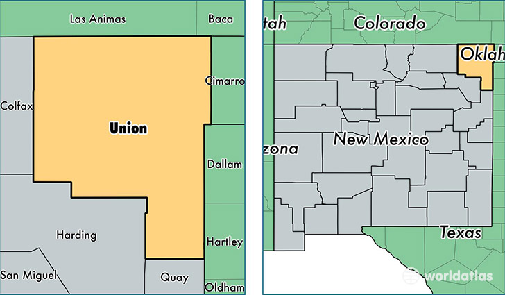
Union County is a county equivalent area found in New Mexico, USA. The county government of Union is found in the county seat of Clayton.
With a total 9,921.92 sq. km of land and water area, Union County, New Mexico is the 135th largest county equivalent area in the United States. Home to 4,297 people, Union County has a total 2294 households earning 38902 on average per year.
Union County, New Mexico offers the following attraction to visitors: Capulin Volcano NM
Union County, New Mexico - Quick Facts
| FIPS Code | 35059 |
| Area Codes | 575 |
| Time Zone | MST |
| Major Cities | Clayton (population: 3,477), Des Moines (population: 286), Folsom (population: 222), Sedan (population: 180), Amistad (population: 126), Grenville (population: 124), Gladstone (population: 65), Capulin (population: 37) |
| Land Area | 1,659 sq miles |
| Water Area | 3,824 sq miles |
| Household Income | $38,902 |
| Housing Units | 2,294 |
| Median Home Value | $86,500 |
| High School Grads | 77% of population |
| Holders of Bachelors Degrees | 17% of population |
| Retail Spending | $7,399 per capita |
| Food & Accomodation Sales | $6,557 per capita |
This page was last updated on June 30, 2016.