Where is Wayne County, Kentucky?
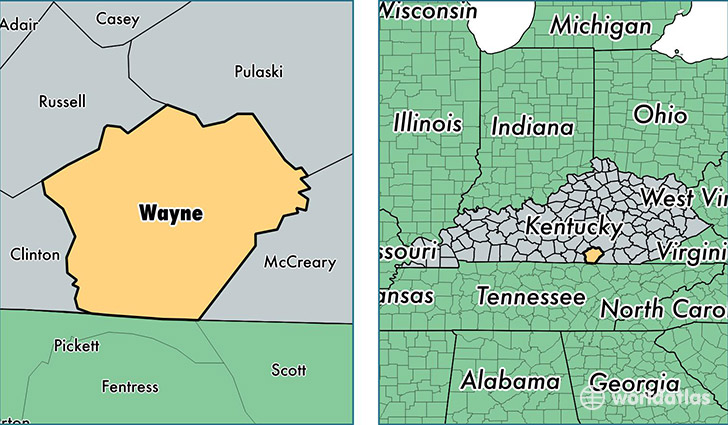
Wayne County is a county equivalent area found in Kentucky, USA. The county government of Wayne is found in the county seat of Monticello.
With a total 1,253.97 sq. km of land and water area, Wayne County, Kentucky is the 2230th largest county equivalent area in the United States. Home to 20,486 people, Wayne County has a total 10792 households earning 29497 on average per year.
Wayne County, Kentucky - Quick Facts
| FIPS Code | 21231 |
| Area Codes | 606 |
| Time Zone | EST |
| Major Cities | Monticello (population: 20,075) |
| Land Area | 7,910 sq miles |
| Water Area | 458 sq miles |
| Household Income | $29,497 |
| Housing Units | 10,792 |
| Median Home Value | $80,500 |
| High School Grads | 70% of population |
| Holders of Bachelors Degrees | 10% of population |
| Retail Spending | $7,412 per capita |
| Food & Accomodation Sales | $18,787 per capita |
This page was last updated on June 30, 2016.