Where is Orland Park, IL?
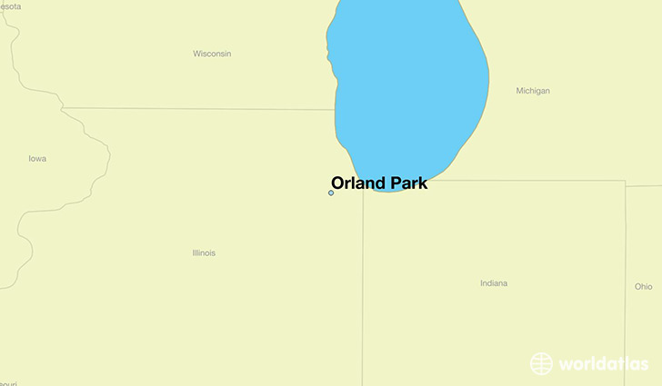
Orland Park is a city found in Illinois, The United States Of America. It is located 41.63 latitude and -87.85 longitude and it is situated at elevation 215 meters above sea level.
Orland Park has a population of 56,767 making it the 22nd biggest city in Illinois. It operates on the CDT time zone, which means that it follows the same time zone as Chicago.
Quick facts
| Country | The United States Of America |
| State | Illinois |
| Population | 56,767 |
| Elevation | 215 m over sea level |
| Time Zone | CDT |
| Longitude | -87.853940 |
| Latitude | 41.630310 |
Orland-park has a population of around 58273, of which 27200 (46%) are male and 31073 (53%) are female. The average age of the inhabitants of Orland-park is 42.85, meaning that the average person is above the national median age of 37. For every male, there are approximately 1.14 females, meaning that the population is relatively evenly distributed between males and female(s).
Of Orland-park's 58273 residents, around 57205 (98.20%) identify as having a single race. The majority of the population is white, which consists of 88.40% of the population. Of the remaining population, 1532 are black/African Americans (2.60%), 110 are native Americans (0.20%), 3489 are asians (6.00%), 6 are pacific islanders (0.00%), 551 are other (0.90%).
The median income of households in Orland-park is $81453.00, meaning that most of the households are above the poverty threshold for families of three. Of the total population, 2.50% of households reported an annual income of less than $10,000.
Orland Park, IL Zipcodes
The city of Orland Park has 6 zipcodes recognized by the United States Census Bureau: 60448, 60452, 60462, 60464, 60467, 60487.