Where is Jackson County, Alabama?
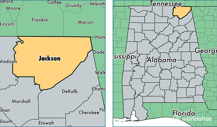
Jackson County is a county equivalent area found in Alabama, USA. The county government of Jackson is found in the county seat of Scottsboro.
With a total 2,918.32 sq. km of land and water area, Jackson County, Alabama is the 644th largest county equivalent area in the United States. Home to 52,665 people, Jackson County has a total 24599 households earning 37634 on average per year.
Jackson County, Alabama offers the following attraction to visitors: Russell Cave NM
Jackson County, Alabama - Quick Facts
| FIPS Code | 1071 |
| Area Codes | 256 |
| Time Zone | CST |
| Major Cities | Scottsboro (population: 21,075), Stevenson (population: 4,888), Pisgah (population: 3,998), Flat Rock (population: 3,903), Section (population: 3,631), Bryant (population: 3,568), Bridgeport (population: 3,468), Woodville (population: 3,391), Dutton (population: 2,559), Hollywood (population: 2,039) |
| Land Area | 20,334 sq miles |
| Water Area | 1,078 sq miles |
| Household Income | $37,634 |
| Housing Units | 24,599 |
| Median Home Value | $93,400 |
| High School Grads | 75% of population |
| Holders of Bachelors Degrees | 13% of population |
| Retail Spending | $7,784 per capita |
| Food & Accomodation Sales | $39,315 per capita |
| Universities and Colleges | Northeast Alabama Community College |
This page was last updated on June 30, 2016.