Where Is The World's Highest Battlefield Located?
In the world there exists much contest between countries over matters such as access to resources and land claims. Such areas have been designated battlefields because of the intensity of battles which take place at the site. While most of the historical battlefields have been turned into memorial sites for the heroes of wars and those who took part in the battle, some of the battlefields today are still danger zones. Some of the memorial battlefields include Rabaul, Antietam, and Fort Douaumont. The Siachen Glacier is perhaps one of the known battlefields because of the Siachen War between India and Pakistan. However, it is also the location for the highest battlefield.
The Cold And Harsh Siachen Glacier
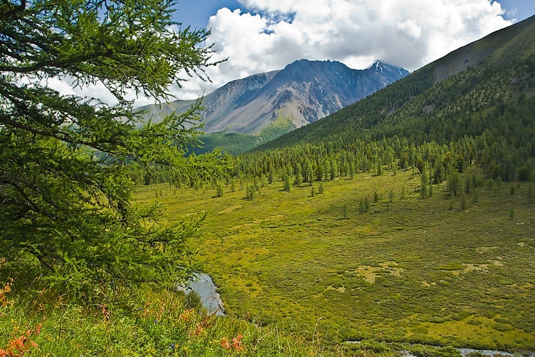
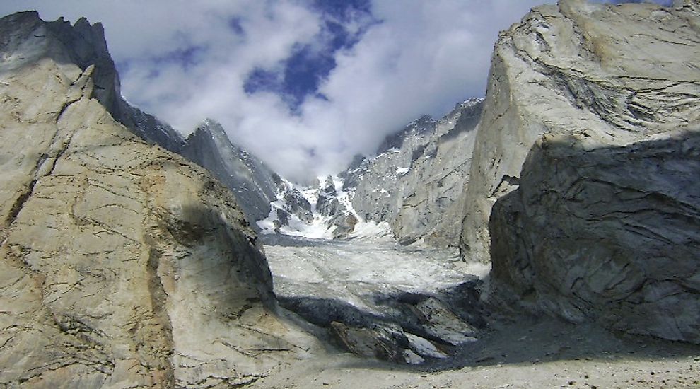
Siachen Glacier has been under the administration of the Indians since 1984. It forms part of the Leh District of the Ladakh Division in the eastern Karakoram Range. It lies on the Line of control between India and Pakistan and forms the longest glacier in the Karakoram. Although the area is under the administration of India, Pakistan controls the region west of Saltoro Ridge. The region falls on an altitude of 18,875 feet above the sea level while the altitude of the crest of the Saltoro Ridge ranges from 17,880 feet to 25,300 feet above the sea level. The average winter fall on the Siachen Glacier is above 35 feet, and temperatures can drop down to -500C. The glacier covers an area of about 270 square miles including the tributary glaciers. The name “Siachen” means land with abundant roses, contrary to the ongoing conflict over the region. The melting glaciers are the source of water for Nubra River in the region of Ladakh in India. The water drains into Shyok Rive then joins Indus River which flows through Pakistan.
The Siachen Conflict
India and Pakistan both claim sovereignty over the Siachen Glacier. Both the US and Pakistan maps consistently showed a dotted line from Line of Control to Karakoram Pass, but India believed that the line was a cartographic error and a violation of the Shimla Agreement. India took over the administration of the region in 1984 through a military operation which was known as “Operation Meghdoot.” The action by the Indian military led to several skirmishes from 1984 to 1999 between India and Pakistan. Pakistan lost over 350 soldiers in different operations between 2003 and 2010 while 869 Indian soldiers have lost their lives since 1984. However, more soldiers from both camps have been lost to the harsh weather condition than from combat. In 2015 alone, over 30 Indian soldiers lost their lives because of the adverse weather. Both camps continue to deploy thousands of their military forces to the area in an attempt to demilitarize the area. However, such attempts have been unsuccessful, and the Siachen Glacier continues to be a major battlefield.
Environmental Effects Of The Battle At The Siachen Glacier
The Siachen Glacier was uninhabited before 1984 with the nearest civilian settlement being about 10 miles away from the glacier. However, the presence of troops and the several operations that have been carried out in the region has caused pollution and increased the rate of melting of the glacier. The ice has been cut and melted by several chemicals to facilitate the military operations. The glacier has receded by more than 800 meters since 1984. The waste material like garbage and plastics find their way into the Indus River which is a major source of water in Pakistan and neighboring countries. Flora and fauna such as the snow leopard and ibex have also been affected by the military activities