The Sights And Sounds Along The Inca Trail In Peru
Also known as the Camino Inka or Camino Inca, the Inca Trail is a well-known hiking trail located in Peru. The trail starts at Mollepata and ends at the famous Machu Picchu in the country’s southern region. The trail has been divided into three parts namely Mollepata, One Day, and Classic Trails. Of these three divisions, the Mollepata T is the one with the highest mountain pass as well as the longest route.
The Camino Inka trail is situated in the Andes mountain range and passes through several features like the alpine tundra and cloud forests. In addition to these features, several settlements, a number of Incan ruins, tunnels, and other features are also on the trail.
The Mollepata Trail
The trail is the first part of the larger Camino Inca Trail and starts at the aged town of Mollepata, which is at an elevation of about 9186.352 feet. From there, mountaineers go over a high pass close to the high and snowy Salcantay peak before heading to the Classic Trail. The Mollepata Trail is generally not that tough but it has some difficult sections such as when it meets up with the Salcantay Trail on the Salcantay peak. Some of the things that make this area more difficult include a high elevation (of up to 16,240.16 feet) and a long route.
The high elevation of the Mollepata Trail is due to the intersection with the tall Salcantay peak, which has elevations of up to a massive 20,574 feet. The Salcantay peak forms part of the Salcantay Trail, which then intersects with the Mollepata Trail forming the tough section for trekkers. Some people opt to go on a trek along the Salcantay Trail due to the overcrowding of the Camino Inca Trail to Machu Picchu.
Visitors and hikers along the Mollepata Trail see a number of sites such as ruins, a beautiful scenery in a remote region, and gorgeous views from atop the Mollepata/Salcantay pass. Just before meeting up with the Classic Trail, hikers also get to see some ruins at Paucarcancha. Even though the ruins are broken down, they still make an impressive site. These ruins feature things like gabled buildings and a nearby river making its way to the convergence with the Rio Apurimac. After this part of the trail, people can go on to the more popular Classic Trail or abandon the trek and go back to the nearby town of Cuzco.
The Classic Inca Trail

Usually, trekkers complete this trail in either four or five days. In some cases, depending on the starting point, they can do so in two days. The trek can be completed in two days if trekkers start from Km 104. The Classic Trail starts from either one of two points from the town of Cusco. The two points are 55 miles and 51 miles from the town along the Urubamba River at elevations of approximately 9,200 feet and 8,500 feet respectively. Regardless of the starting point, the two points converge close to the Patallaqta or Llaqtapata ruins, which is an ancient site that is used for religion, housing soldiers, and agriculture. Close to the Patallaqta ruins, which are on top of a hill, is another ancient site known as Willkaraqay, which dates as far back as 500 BC. From these ruins, the trail moves down towards the Kusichaka River.
At approximately 9,800 feet at the village of Wayllapampa or Wayllabamba, the Classic and the Mollepata Trails intersect. The old village has about 400 inhabitants divided into small settlements of about 130 families. From the village, the trail heads west up the Kusichaka River’s tributary. Up until the village, trekkers are allowed to have animals such as horses and mules. However, the trail up the tributary of the Kusichaka River has to be passed by foot due to extensive damage by trekkers using animals.
Trekkers eventually get to the pass known as Warmi Wañusqa, which is a phrase that translates to the "Dead Woman's Pass." Looking like a supine woman, the pass comprises several habitats like cloud forests with plenty of Polylepis trees. The pass has an elevation of about 13,829 feet above sea level, which makes it the highest point along the Classic Trail. Close to the pass is a camping site at lulluch'apampa or Llulluchapampa, which has a height of about 12,500 feet. Further down, at a height of 1968.5 feet and 1.3 miles away, trekkers get to the Pakaymayu drainage.
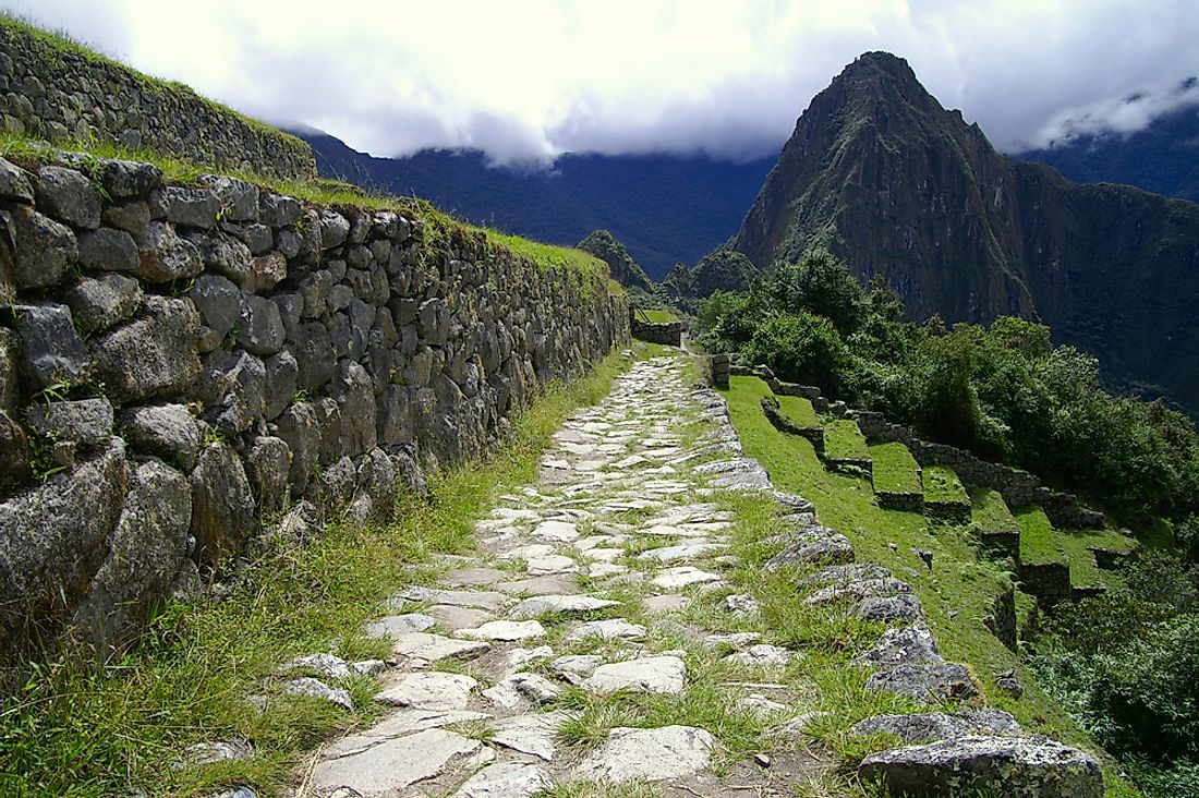
After the drainage, the trail leads to the ruins known as Inca tampu Runkuraqay at a height of around 12,300 feet. This ancient site had some restoration work done in the late 1990s. Further, trekkers see the small lake of Quchapata or Cochapata and its surrounding region, which is full of deer and was once used as a campsite before it was overused. Other sites for trekkers include the archaeological sites of Sayaqmarka and tampu Qunchamarka. In addition, there is a long tunnel overlooking the valleys of Urubamba and Aobamba.
Other ruins around the above tunnel include the Phuyupatamarka, which was discovered by Hiram Bingham III. Based on the evidence, the site was probably used for religious practices. From there, trekkers drop some 3280.84 feet using irregular staircase with around 1,500 steps. Vegetation and animal life is denser in this area. Visitors also get to see another tunnel and several sites along the Willkanuta River. Closer to the newly discovered Intipata, which is situated after the town of Machupicchu, trekkers see other sites like the nearby campsite of Wiñay Wayna. Intipata or Yunkapata is a newly discovered agricultural site that was used to grow several crops like maize and potatoes.
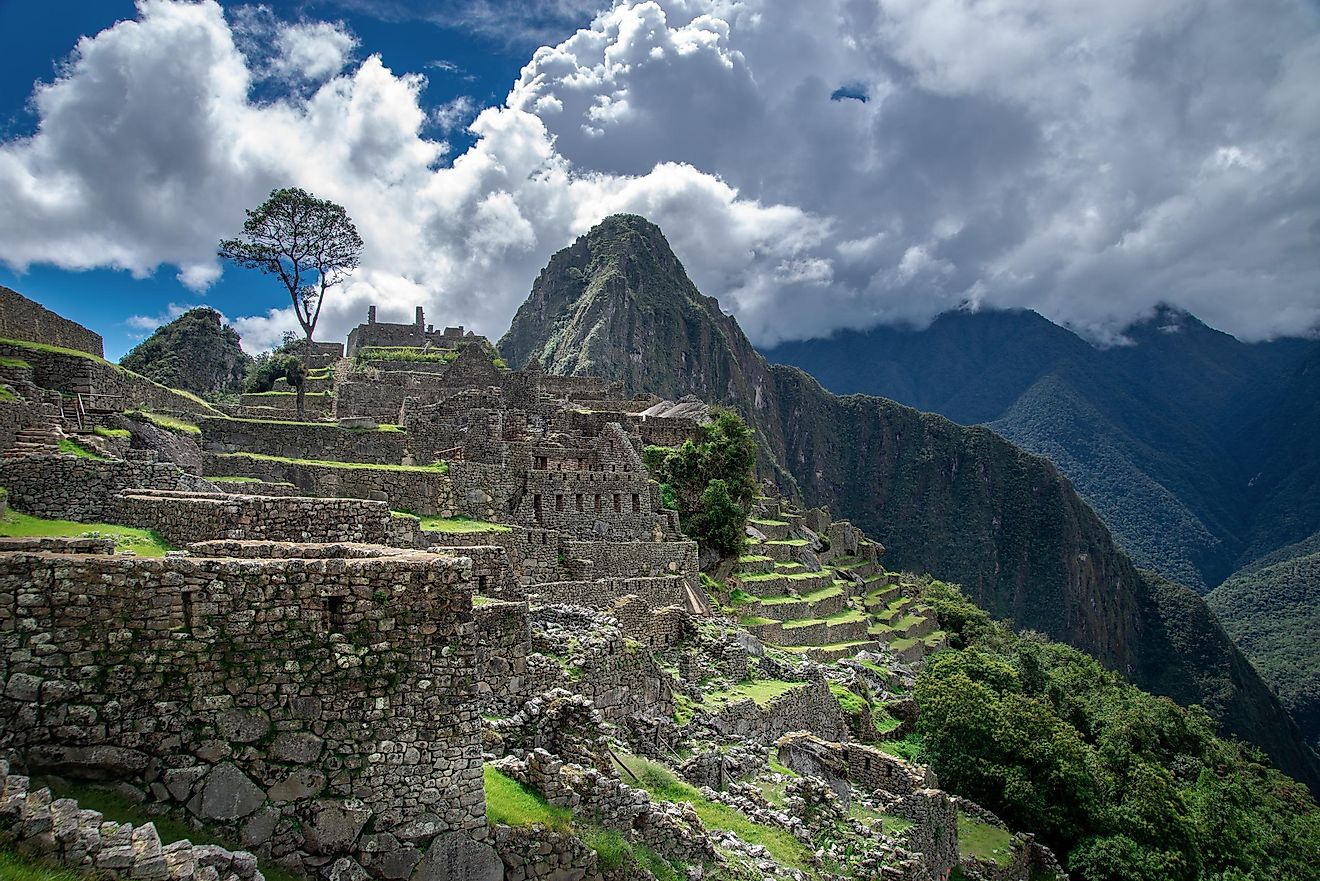
From these two sites, visitors begin the final trail to Machu Picchu ruins. Before getting to the final ruins, trekkers go through Inti Punku (the sun gate), which is about 1.9 miles away. The sun gate has a crest that offers a stunning view of the Machu Picchu ruins below, which is the final point of the trail. Machu Picchu is also known as the “Lost City of the Incas."