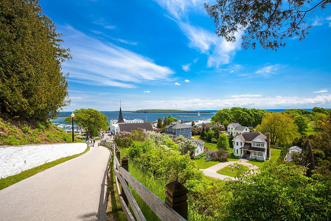
National Tourist Routes of Norway
The Norwegian Public Roads Administration has designated 18 highways in the country as National Tourist Routes because of their scenery and tourist-friendly infrastructure. The highways are located along the West Coast and Southern Norway and cover 1,150 miles. Accommodation, cultural activities, and other activities relevant to the tourists are coordinated by the authorities along the tourist roads. The objective of the project is to promote tourism in the rural areas through which the routes run. The 18 tourist routes of Norway are:
18. Andøya (Åkneskrysset–Andenes)
The Andoya route runs along the west coast of Andoya, an island of the Vesteralen archipelago, with several fishing hamlets located along the white beaches. The route connects to Senja, another National Tourist Route, by ferry. The island features some of the country largest marshes. Tourists using this route can also spot some whales and seals in the Norwegian Sea.
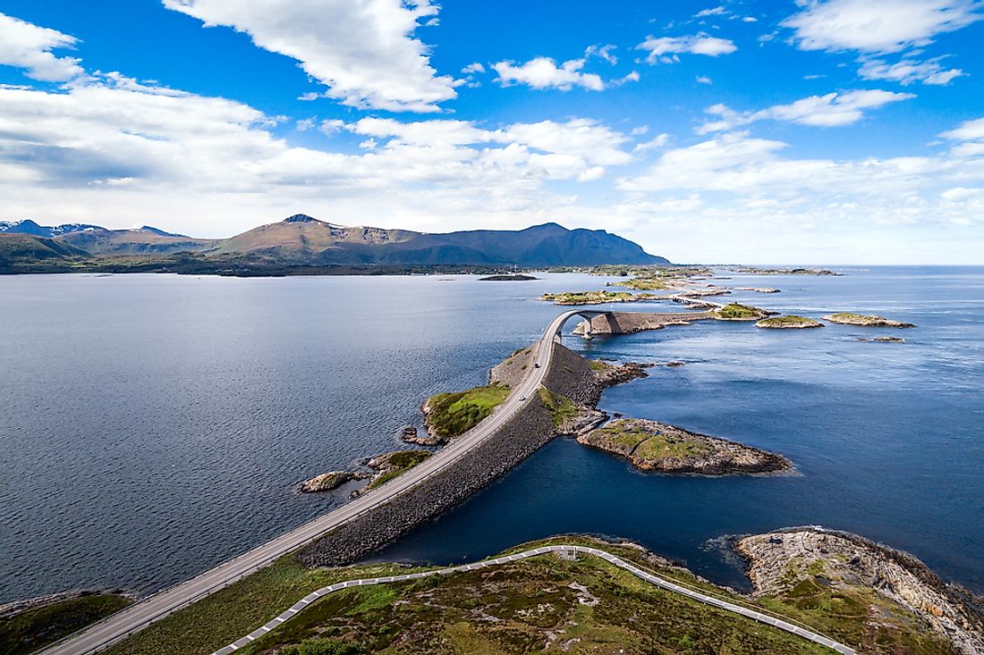
17. Atlantic Ocean Road (Kårvåg–Bud)
Atlantic Ocean Road extends from Karvag to Vevang and continues along the coast of Hustadvika which is a popular ship graveyard. The route is constructed across small unsheltered islands. Atlantic Ocean Road is spanned by several bridges, causeways, and viaduct. The route covers a distance of approximately 22 miles (51 km).
16. Aurlandsfjellet (Aurlandsvangen–Lærdalsøyri)

Aurlandsfjellet route is located in the county of Sogn og Fjordane, covering a distance of approximately 29 miles. It passes through Lærdal Tunnel the longest road tunnel in the world. The barren plateau provides a magnificent view of the Aurlandsfjord which is located about 2,000 feet below.
15. Gamle Strynefjellsvegen (Grotli–Ospeli)
Gamle Strynefjellsvegen route was officially opened in 1894 and measures approximately 17 miles. It connects the mountain village of Skjak to the village of Stryn and passes through glaciated forms in the east. The route also passes through the steep and rugged topography of the west. The route is often closed until July of every year.
14. Gaularfjellet (Balestrand–Moskog)
Gaularfjellet route is approximately 57 miles long and acts as an alternative route between Sogn and Sunnfjord. The route starts at Sognefjord and goes through lakes, rapids, waterfalls. The route has several accessible places that allow the visitors to enjoy the surrounding nature. The highlight on this road is probably the bridge over the Likholefossen waterfall.
13. Geiranger–Trollstigen (Langevatn–Sogge Bridge)
The drive along Geiranger–Trollstigen route is more dramatic than most of the other National Tourist Routes in Norway. The route has several highlights including the eleven bends, lush valleys, and a strawberry field. Driving along the road, one will see notice the installations constructed along the road. The route also has several viewing points such as Flydalsjuvet gorge and Gudbrandsjuvet gorge which allows the visitors to explore the natural surroundings.
12. Hardanger (Halne–Steinsdalsfossen, Jondal–Utne, Kinsarvik–Tyssedal)
Hardanger route is a 121-mile route consisting of three sections in Hardanger. The sections vary from fjord landscape to moorlands, mountains, and glaciers. The area bordering the route is characterized by waterfalls. The region is known as a Norwegian romantic nationalism with several activities taking place on the roadside including the sale of fruits and traditional handicrafts.
11. Havøysund (Russelv–Havøysund)

Havøysund route runs through a deserted Arctic wilderness with the sea on one side and barren mountains on the other side. The route is approximately 41 miles and dominates the county of Finnmark. The area is sparsely populated except for the small fishing village of Havøysund
10. Helgeland Coast North (Stokkvågen–Storvika)
Helgeland Coast North is an alternative route to the E6. Running north-south through Helgeland, the route is paraded by over 10,000 islands on the sea-side and glacier Svartisen and Engabreen on the land-side. The Saltstraumen, one of the most powerful tidal currents in the world, lies to the north of the route.
9. Helgeland Coast South (Holm–Alstahaug)
Helgeland Coast South route is also a coastal alternative route for E6. The 97-mile long route runs through a large archipelago, providing access to the islands by the ferry. The most popular island is the Vega Island which is a World Heritage Site. Other outstanding features characterizing this route include the Seven Sisters of Alstahaug and the Torghatten Mountain which has a natural hole through it.
8. Jæren (Ogna–Bore)
Jæren route differs from most of the other tourist routes in Norway. It is a regular, all-purpose road that runs along the uninterrupted Jæren coastline, offering views of sandy beaches and sand dunes. Tourists using this road must be prepared to share it with regular users. The coastline also features several lighthouses. The route also offers a view of the largest lowland region of Norway dominated by agricultural activities and well-kept cultural landscape.
7. Lofoten (Fiskebøl–Å)

The Lofoten route passes through the Lofoten archipelago which is characterized by open sea, currents, beaches, steep mountains. The fishing hamlets along this route do not only promote the fishing industry in the area but also promotes and preserve the active cultural heritage in the area. The road is open throughout the year.
6. Rondane (Enden–Folldal)

The Rondane route is sandwiched between the Rondane National Park and Rondane massif which is located on the east and a cultural landscape on the west. The mountains provide hiking haven for the visitors for and are also well suited for a summer tour. Several mines also dot the route, especially at Folldal.
5. Ryfylke (Oanes–Sauda–Horda)
The 114-mile Ryfylke route is full in contrast. The southern part of the region has fertile soil contrasting the northern side which has rockslides, cliffs, and mountains. Ryfylke route offers a lot of opportunities to make a detour and take a break from driving and explore the history of Sauda industry or the lovely little shore villages.
4. Senja (Gryllefjord–Botnhamn)
Senja route provides a breathtaking sight of the steep mountains plunging deep into the ocean. Some parts of the route are narrow and twist and turn along fjords and ice-cold waters. The route is slightly raised above the magnificent surrounding at Bergsbotn. Senja provides an ample opportunity for nature lovers to explore nature.
3. Sognefjellsvegen (Lom–Gaupne)

The sognefjellsvegen route ascends through the valley and makes its way up the summit at 1434 meters, making it the highest mountain pass in Northern Europe. The road starts from Lom and passes through a small village and several natural beauties. The route is only opened to the public in the summer during which it provides a view of mountain lakes. It also provides access to the Jotunheimen National Park.
2. Valdresflye (Garli–Besstrond)
Valdresflye route stretches along sweeps of undulating terrain. The natural surrounding is alluring and within reach of the mountains on the horizon. On the mountain plateau of Valdresflye, the road has a view towards the Jotunheimen National Park. Further down the road is a cultivated landscape with mountain pastures. The route is closed during winter due to huge snow masses.
1. Varanger (Varangerbotn–Hamningberg)

Varanger route follows the east coast of Varanger. Varanger offers physical experience as well as serenity on the road. Tourists using this route will have to drive birch wood and rugged cliff landscape. During winter, the Varanger coastline is rampaged with storms and Arctic night. Bird watching is a common activity along the road with several bird-watching hides built along the road.