Bonneville Salt Flats - Unique Places Around The World
Bonneville Salt Flats is an extensive salt pan that is located in the arid regions of Western United States. It is found in the northwestern Utah in Tooele County, and is a public property which is managed and taken care of by the Bureau of Land Management. The salt flat is open to the public and entry is free of charge. It is usually opened to the public most times during the year, with a few occasional restrictions, especially during events. The area was named after Benjamin Bonneville by Grove Karl Gilbert, a famous geologist. Benjamin Bonneville was US army officer who carried out an exploration works in the Intermountain Region in the 1830s
Geography
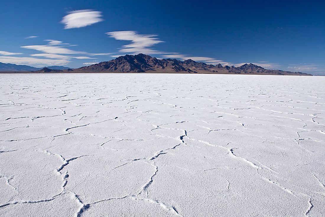
As indicated above, the Bonneville Salt flat is located in northwestern regions of Utah. It is part of the Great Salt Lake Desert. The Bonneville Salt flat borders the interstate 80 in Utah to the south, and the West Wendover in Nevada to the west. It is located at an altitude of 4,219 feet. The Bonneville Salt Flats covers a total area of 104 square kilometers.
Formation of the Bonneville Salt Flats
The Bonneville Salt Flats came into existence after the disappearance of Lake Bonneville. Lake Bonneville existed during the Pleistocene period. The Lake Bonneville was large enough to be compared to the size of the present day Lake Michigan. The lake was a pre-historic lake whose disappearance is believed to have happened approximately 14,000 years ago. The drying up of the lake is attributed to the climatic change which was characterized by high temperatures and low precipitation. The pluvial lake covered most of the eastern region of the Great Basin. Most of its area covered present-day Utah, with little extensions to present day Nevada and Idaho. The levels of the lake reduced to the Provo level after the Bonneville Floods. With the effects of the climate change, the lake gradually dried up. After the lake completely dried up, it left behind the Great Salt Lake, Utah Lake, Sevier Lake, Rush Lake, and Little Salt Lake as remnants. After the evaporation of the waters of the pre-historic Bonneville Lake, a solid layer of salt was left lying behind, forming the present-day Bonneville Salt Flats. The evaporation left behind minerals such as potash and halite.
Activities in the Bonneville Salt Flats
Bill Rishel and two other businessmen tested whether the salts could create a suitable driving path. These tests led to the construction of the railway line that cuts across the Bonneville Flats. The construction of the Railway line was completed in 1910, making it the first permanent crossing in the region. The Bonneville Salt Flats has also been known to be an important area in the film and entertainment industries. Movies that have scenes filmed at the Bonneville Salt Flats include Knight Rider, Warlock, The Brown Bunny, Top Gear, The Tree of Life, and The World’s Fastest Indian. Land Speed events such as motor car racing are very common on the Bonneville Salt Flats. Racing takes place in the Bonneville Speedway, a part of the salt flats set aside for speed racing.