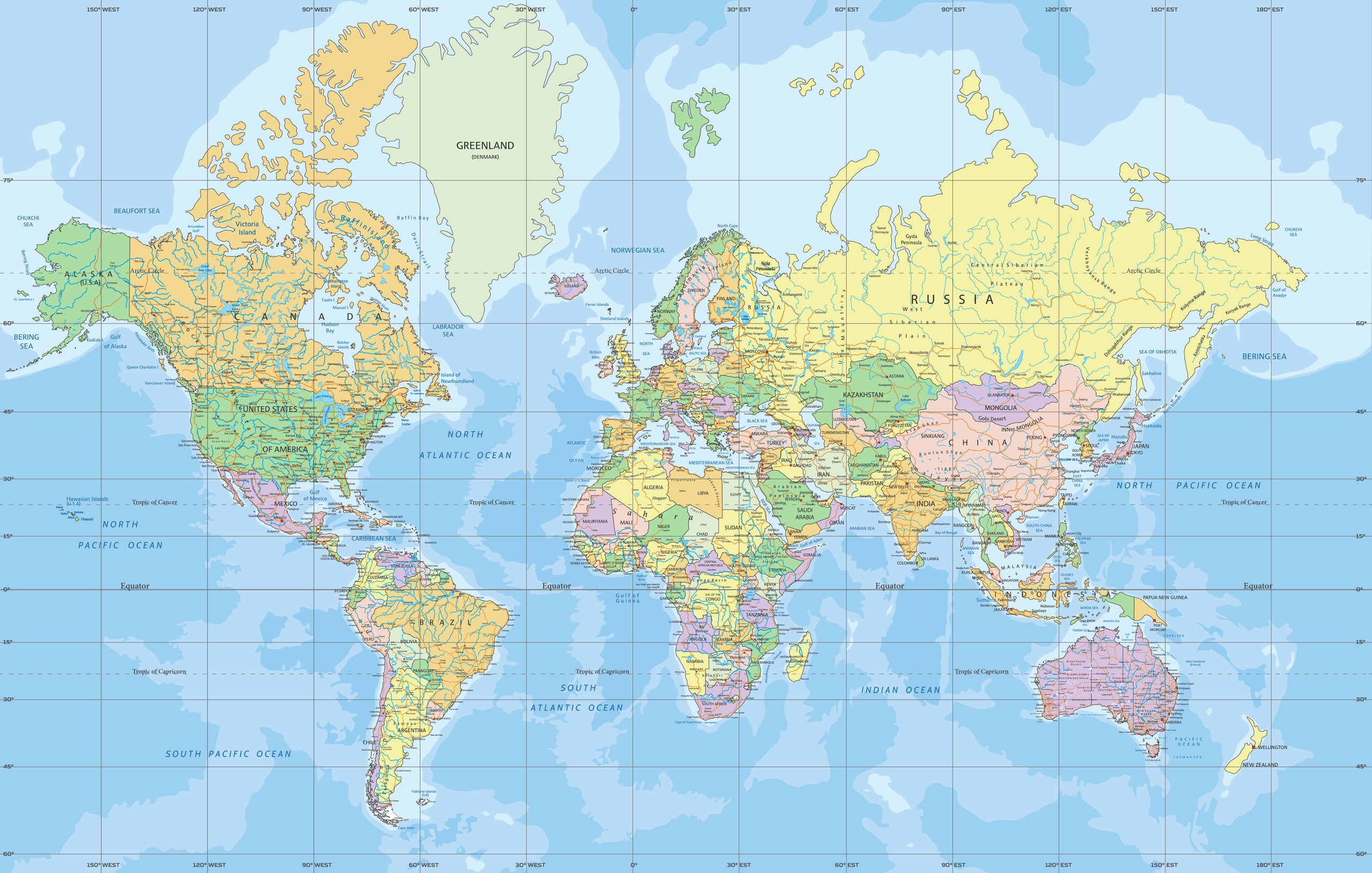
World Map - Mercator Projection
A cylindrical map is one of the ways of displaying the Earth on a flat surface. These map projections feature straight coordinate lines, with meridians crossed at a right angle by the horizontal lines. Examples of cylindrical map projections are Cassini, Miller, Gall-Peters, and Mercator. Mercator is one of the most popular map projections because it preserves locations and shapes and represents south as down and north as up. Although it is a cylindrical projection, Mercator projection is derived mathematically.
Origin
Although the origin of the Mercator Projection is still a subject of debate, Gerardus Mercator is credited with introducing the map projection. Mercator, whose official name was Gerhard Kremer, produced a planispheric map in 1569, measuring 80 by 49 inches, and printed the map on 18 different sheets. He further titled the map and gave an elaborate explanation on how to use the map projection. However, Mercator did not explain how he constructed or arrived at the map projection. The projection was intended to aid sailors with their navigation.
Properties
The Mercator projection features equally-spaced meridians and straight parallels perpendicular to each other. The distance between the parallel horizontal parallels increases with distance from the equator, allowing for the map’s west-east and north-south stretching. Thus, the Mercator map’s linear scale increases with latitude, and point locations on the north-south scale are the same as point locations on the west-east scale.

Distortions
Like all the map projections, Mercator projection distorts the Earth surface’s true layout, size, and shape. Because the projection’s linear scale increases with latitude, the geographical areas far from the equator always appear distorted. Mercator projection cannot be used at latitudes above70 degrees south or north since the linear scale is much larger at the poles. The map projection exaggerates areas like Antarctica, Greenland, Ellesmere Island, and Svalbard, which all appear much larger.
Uses
Almost all navigation charts are printed based on the Mercator projection. The projection was initially intended to assist marine navigators and contains features suitable for navigation. All the straight lines on the projection map have constant bearings. Also, street map services are based on the Mercator projection.


