International Date Line
It is common knowledge that the Earth is round, and navigational information is obtained by drawing imaginary lines to determine latitude, longitude, prime meridian, and the equator. The South Pole and the North Pole are Earth’s main reference points, located at the northern and southern extremes of the world. An imaginary line drawn halfway between these two points is the equator, while lines drawn above or below the equator are latitudes. Parallel lines, running from the North to the South Poles, are known as longitudes. The International Date Line (IDL) is also an imaginary line that runs from the North to the South Pole and separates two calendar days. The IDL is important in measuring time and is crucial for instantaneous communication, politics, and commerce.
What Is The International Date Line?

The IDL is an imaginary line that roughly follows the 180° line of longitude and passes through the Pacific Ocean. However, this line is not straight and strays from the 180° meridian at certain points. In some places, it appears as zig-zag, deviating to the meridian’s east or west. The deviations enable places of the same economic and political affiliations to share the same date or time. Otherwise, if the IDL were a straight line, it would divide certain landmasses into two parts with two different dates on the same day.
From the North Pole, the IDL first bends to the east to pass near the Chukchi Peninsula (Russia) and Wrangel Island’s east, then proceeds through the Bering Strait before bending towards the west of St. Matthew and St. Lawrence Islands. From there, the line runs between the Commander Islands and the Aleutian Islands and returns to the 180° meridian until it passes the equator. Below the equator, the line swings far to the east, near the 150° meridian, and circumscribes Kiribati. It then returns westward but remains to the 180° longitude’s east, passing through American Samoa and Samoa. Finally, the line bends southwestwards and follows the 180° meridian until it reaches Antarctica.
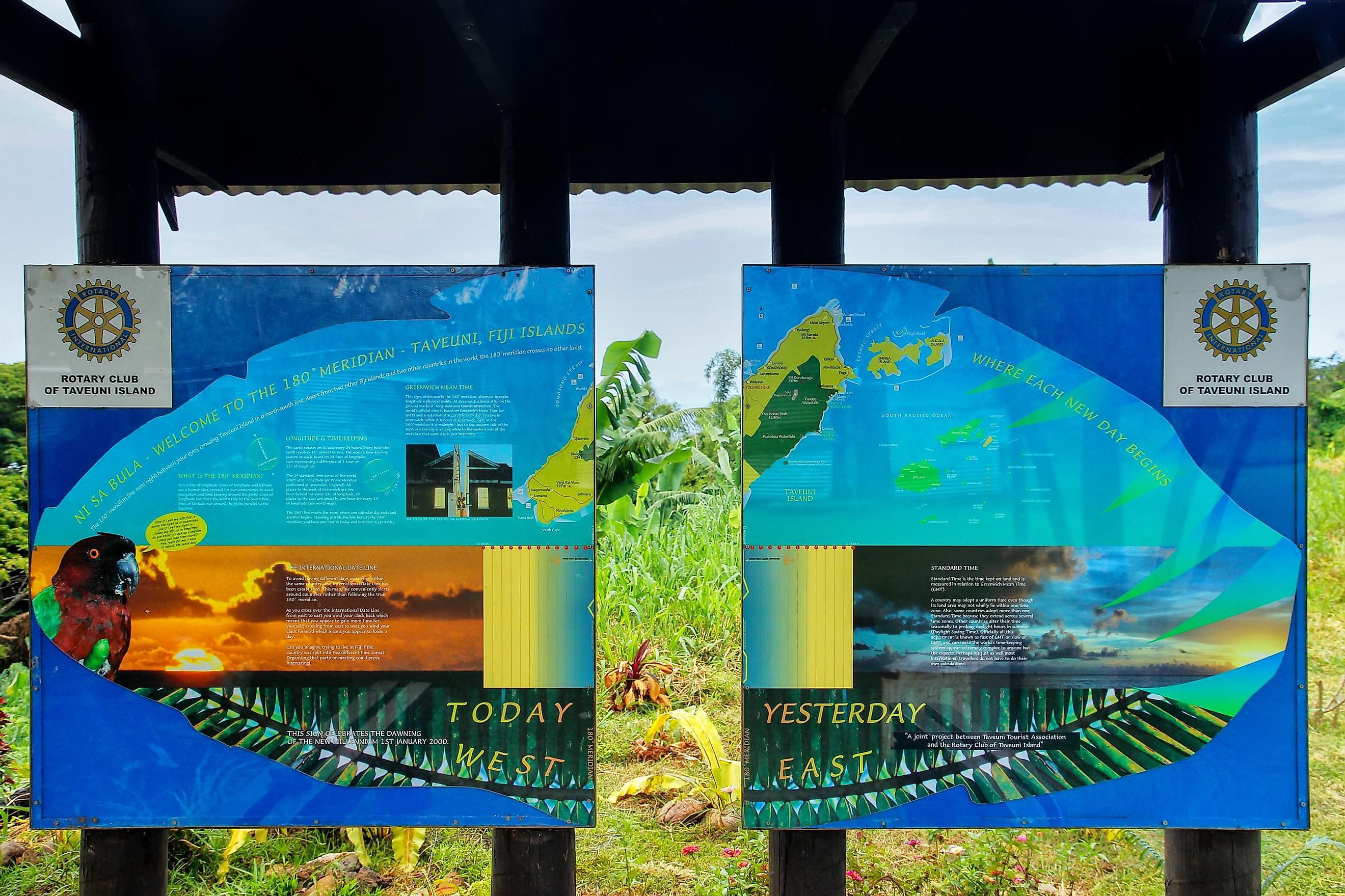
Why The 180° Meridian?
The IDL was established in 1884 by the International Meridian Conference as an imaginary line roughly following the 180° meridian and not any other meridian (including the Prime Meridian). The conference, attended by 26 nations, settled on 180° longitude because it runs through an open ocean (Pacific Ocean) and zig-zagged it to keep the surrounding nations, especially island countries, within the same day and date.
An Extra Day And Three Dates at Once

People traveling westward from the IDL gain one hour every 15° of longitude crossed, while those traveling eastward lose one hour. Therefore, people traveling westwards without adjusting their time back by an hour for every 15° meridian will discover that they have gained an extra day when they return home. This happened to Ferdinand Magellan’s crew after their 1522 expedition. However, one loses 24 hours or one day if they travel eastwards around the globe.
For two hours a day, between 10:00 and 11:59 UTC, there are three separate calendar dates. For example, at 10:30 UTC on Friday, it is 11:30 PM Thursday in American Samoa, 12:30 AM UTC Saturday in Kiritimati and 6:30 AM UTC Friday in New York. Baker Island and Howland Island have the Earth’s latest time at UTC-12, while Kiritimati (Kiribati) is among the first places to see a new day at UTC+14.


