Andaman And Nicobar Islands
The Andaman and Nicobar Islands, separating the Bay of Bengal and the Andaman Sea, comprise two main island groups; the Nicobar Islands and the Andaman Islands. The islands are located in the Bay of Bengal and are possessed by India. Andaman and Nicobar Islands consist of 572 islands, of which only 38 have permanent populations. In 2004, a tsunami, triggered by an earthquake in the nearby Indian Ocean, severely damaged the islands, drawing global attention.
Location

The Andaman and Nicobar Islands are located on the Bay of Bengal’s southeastern edge. The two island groups, Nicobar Island and its northern neighbor, form an arc that stretches towards the south for about 1,000 kilometers between Sumatra (Indonesia) and Myanmar. The arc also forms a boundary between the Andaman Sea on the east and the Bay of Bengal on the west.

The Andaman and Nicobar Islands are approximately 150 kilometers north of Aceh (Indonesia). The Andaman Sea separates the island group from Myanmar and Thailand. The Andaman Islands are located about 130 kilometers southwest of the Ayeyarwady Region, Myanmar, while the Nicobar Islands are located about 1,300 kilometers southeast of the Indian subcontinent. These two island groups are separated by the Ten Degree Channel. The Andaman and Nicobar Islands form Indian Union Territory.
Climate
The Andaman and Nicobar Islands region experiences a tropical climate, moderated by the sea breeze. Temperatures on the islands rise from 70 degrees Fahrenheit to around 80 degrees Fahrenheit daily all year round. The region receives plenty of rainfall, averaging 3,000 mm annually. The southwest monsoons, blowing between May and September, and tropical cyclones (October to November) bring plenty of rainfall to the island. Greater Nicobar receives the most rainfall than other places in the Andaman and Nicobar Islands.
Geography Facts
The Andaman and Nicobar Islands comprise 572 islands, spanning 8,249 square kilometers. The two island groups are separated by Ten Degree Channel. The channel is about 10 km long from west to east and 150 km wide from north to south. Its minimum depth is 7.3 meters.
The Andaman comprises 325 islands, occupying 6,170 square kilometers. South, Middle, and North Andamans, collectively known as Great Andaman, are the archipelago’s main islands. Other Islands are Little Andaman, Interview, Sentinel, Rutland Island, and The Sisters. On the other hand, Nicobar consists of 247 islands, covering 1,765 square kilometers. Its main islands include Great Nicobar, Car Nicobar, Katchall, Camerota, and Noncowry Islands. Sumatra’s northwestern tip is approximately 150 km southwest of the island of Great Nicobar.
Andaman and Nicobar Islands are parts of the island arc. The island arc is part of several submarine mountain ridges, including Patkai Range, Mentawai Ridge, and Rakhine Mountains. The highest point on the union territory is Saddle Peak, with an elevation of 732 meters above sea level. Saddle Peak is located on North Andaman Island. Other major peaks are Thullier (642 meters) and Mount Harriet (365 meters). The Barren Island on the Andaman and Nicobar Islands is the only active volcanoes in India and South Asia.
Nicobar has a more diverse terrain than Andaman, with some of its islands, like Car Nicobar, having flat surfaces covered by corals. The offshore coral formation makes it difficult for most ships to anchor on the islands. Other islands are hilly and contain numerous streams. Only Great Nicobar has plenty of fresh water in the region. The Andaman Islands has rough terrain, with enclosing hills and valleys. Betapur and Diglipur valleys in the Middle and North Andaman are some of the few valleys on Andaman with flat terrain.
Brief History

The Andaman Islands were mainly occupied by the Andamanese people, while the Nicobar Islands were home to various ethnic groups, collectively known as Nicobarese people. From 1014 to 1042 CE, Rajendra Chole I of the Chole Empire used the islands as a naval base to launch an attack against the Srivijaya Empire (now Indonesia) and referred to the island as Ma-Nakkavaram,” meaning great naked/open land.
The Danish arrived on the islands in 1755 and made Nicobar a Dutch colony the following year. They first named the island “New Denmark” and later “Fredrick’s Island.” However, they abandoned the islands severally due to a malaria outbreak. Between 1778 and 1784, Austria established a colony on the islands, assuming that the Danish had abandoned them. They renamed the islands “Theresia Islands.” In 1789, the British established a naval base on Chatham Island, the current Port Blair location.
In October 1868, the Danish sold the Nicobar Islands to the British, who set up a penal colony for Indian subcontinent convicts. In 1872, Nicobar and Andaman became a single administrative unit, with a chief commissioner based in Port Blair. The islands were included as part of India in 1950 and declared a union territory in 1956.
On December 26, 2004, a 10-m high tsunami hit the islands. The tsunami was caused by an undersea megathrust (earthquake), leading to over 2,000 fatalities and rendering 40,000 people homeless. Some of the worst affected islands were Indira Point and Katchal. A significant portion of the Andaman and Nicobar Islands was submerged, reducing the union territory’s area from 8,073 square kilometers to 7,950 square kilometers.
Flora And Fauna

Most parts of the Andaman and Nicobar Islands are covered in dense tropical rainforests. The forests comprise floral characteristics of Myanmar, India, and Malaysia. There are over 2,200 plant species on the islands, of which 200 are endemic. Common plants include Andaman redwood (narra), fern, and orchid. Deciduous forest covers part of the Middle Andaman Islands, while North Andaman Islands have plenty of evergreen trees. Grassland is only found on the Nicobar Islands.
The tropical rainforest has a rich diversity of fauna despite being cut off from the mainland. 50 mammals, including endemic species such as Andaman wild boars, live on the islands. There are also 26 rodents and 14 bat species. Mammals include Andaman and Nicobar wild boars, spotted deer, shrew, elephants, and dugongs, which is Andaman State animal. Birds species are approximately 270, of which 14 are endemic.
Economy
Andaman and Nicobar Islands’ economy is based on agriculture and tourism, with agriculture as the main source livelihood source for most households. Approximately 487 square kilometers of land is under agriculture. Paddy is the main crop on the islands, while other crops include pulses and vegetables. Fruits such as orange, mango, and pineapple are widely grown in hilly areas.
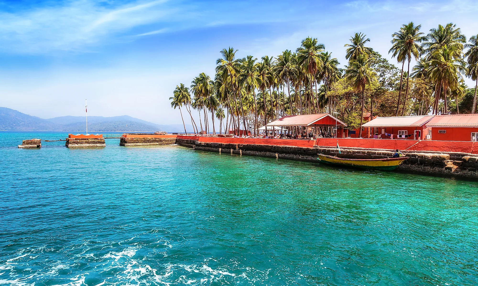
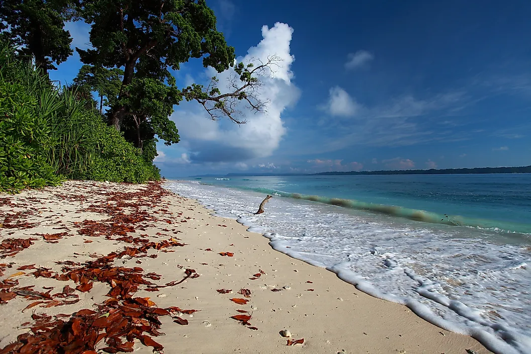
The islands have pristine beaches that have become attractive tourist destinations. Water sport activities such as sea-walking and snorkeling are increasingly becoming popular on the islands. Plans to develop some islands into luxury resorts are underway. Some of the islands planned for development under the National Institute for Transforming India (NITI) are Smith, Avis, and Long Islands. According to recent estimates, 430,000 tourists visited the islands in 2016-2017, up from 130,000 a decade ago.
Demography

Although Andaman and Nicobar Islands comprise over 500 islands, only 38 are inhabited. The Union Territory has an estimated population of 380,000, of which 53% are males. The Andaman Islands account for about 90% of the total population, while the rest live on the Nicobar Islands. Port Blair is the territory’s largest and capital city, with an estimated population of 141,000.
There are approximately 450 native Andamanese people in the Andamans, while the Nicobarese are the majority in the Nicobar Islands. The indigenous Andamanese include Sentinelese and Jarawa. The majority of the islanders speak Bengali or Hindi, while Malayalam, Telugu, and Tamil are also common. Hindi is the territory’s official language. English is also used for official communication. The major religion is Hindu (69.5%), followed by Christianity at 21.7%.
Administration
Nicobar and Andaman Islands were put into one administrative unit in 1874 by the British. The territory is subdivided into three districts; Nicobar, South Andaman, and North and Middle Andaman. The districts are further subdivided into sub-divisions and townships (taluks). South Andaman has three sub-divisions and four taluks, including Port Blair taluk. The Union Territory is headed by Lieutenant Governor. It is represented in the House of the People (Lok Sabha) by one person from its Lok Sabha constituency.
Travel

Port Blair, Andaman and Nicobar Islands’ capital and largest city, serves as the entry point to the Union Territory. It can be accessed from mainland India by either sea or air. Port Blair Airport, also known as Veer Savarkar International Airport, is the primary airport serving the islands. It is situated approximately 2 kilometers south of the capital. A flight takes 2-3 hours from mainland India to the airport. It takes 3-4 days to travel from Port Blair to Visakhapatnam, Chennai, or Kolkata.


