Where is Niobrara County, Wyoming?
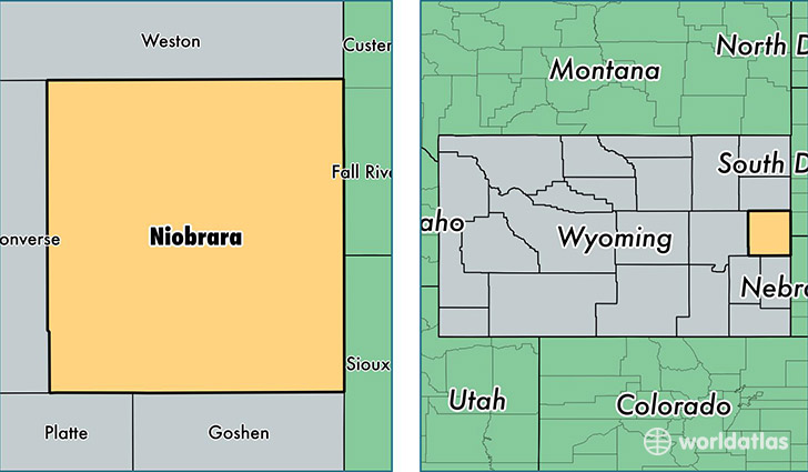
Niobrara County is a county equivalent area found in Wyoming, USA. The county government of Niobrara is found in the county seat of Lusk.
With a total 6,806.32 sq. km of land and water area, Niobrara County, Wyoming is the 217th largest county equivalent area in the United States. Home to 2,463 people, Niobrara County has a total 1331 households earning 38438 on average per year.
Niobrara County, Wyoming - Quick Facts
| FIPS Code | 56027 |
| Area Codes | 307 |
| Time Zone | MST |
| Major Cities | Lusk (population: 2,045), Manville (population: 238), Lance Creek (population: 105) |
| Land Area | 951 sq miles |
| Water Area | 2,626 sq miles |
| Household Income | $38,438 |
| Housing Units | 1,331 |
| Median Home Value | $147,700 |
| High School Grads | 91% of population |
| Holders of Bachelors Degrees | 19% of population |
| Retail Spending | $8,408 per capita |
| Food & Accomodation Sales | $3,071 per capita |
This page was last updated on June 30, 2016.