Where is Jackson County, Mississippi?
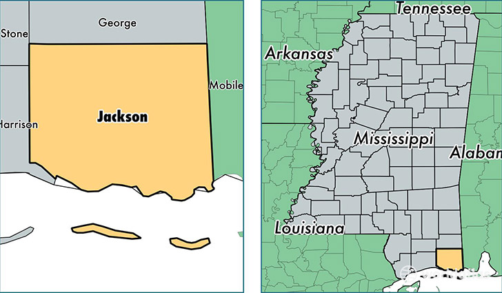
Jackson County is a county equivalent area found in Mississippi, USA. The county government of Jackson is found in the county seat of Pascagoula.
With a total 2,702.4 sq. km of land and water area, Jackson County, Mississippi is the 722nd largest county equivalent area in the United States. Home to 141,137 people, Jackson County has a total 60678 households earning 48943 on average per year.
Jackson County, Mississippi - Quick Facts
| FIPS Code | 28059 |
| Area Codes | 228 |
| Time Zone | CST |
| Major Cities | Ocean Springs (population: 37,118), Moss Point (population: 31,844), Pascagoula (population: 22,435), Vancleave (population: 19,541), Gautier (population: 17,251) |
| Land Area | 54,493 sq miles |
| Water Area | 723 sq miles |
| Household Income | $48,943 |
| Housing Units | 60,678 |
| Median Home Value | $123,300 |
| High School Grads | 86% of population |
| Holders of Bachelors Degrees | 20% of population |
| Retail Spending | $9,964 per capita |
| Food & Accomodation Sales | $178,044 per capita |
This page was last updated on June 30, 2016.