Where is Bracken County, Kentucky?
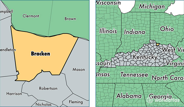
Bracken County is a county equivalent area found in Kentucky, USA. The county government of Bracken is found in the county seat of Brooksville.
With a total 541.17 sq. km of land and water area, Bracken County, Kentucky is the 3008th largest county equivalent area in the United States. Home to 8,406 people, Bracken County has a total 3802 households earning 39196 on average per year.
Bracken County, Kentucky - Quick Facts
| FIPS Code | 21023 |
| Area Codes | 606 |
| Time Zone | EST |
| Major Cities | Brooksville (population: 4,120), Augusta (population: 2,511), Foster (population: 1,736) |
| Land Area | 3,246 sq miles |
| Water Area | 206 sq miles |
| Household Income | $39,196 |
| Housing Units | 3,802 |
| Median Home Value | $90,700 |
| High School Grads | 81% of population |
| Holders of Bachelors Degrees | 14% of population |
| Retail Spending | $3,007 per capita |
This page was last updated on June 30, 2016.