Where is Logan County, Kansas?
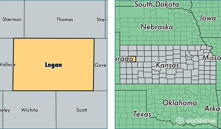
Logan County is a county equivalent area found in Kansas, USA.
With a total 2,779.32 sq. km of land and water area, Logan County, Kansas is the 694th largest county equivalent area in the United States. Home to 2,794 people, Logan County has a total 1442 households earning 41765 on average per year.
Logan County, Kansas - Quick Facts
| FIPS Code | 20109 |
| Area Codes | 785 |
| Time Zone | CST |
| Major Cities | Oakley (population: 2,568), Winona (population: 348), Monument (population: 159) |
| Land Area | 1,079 sq miles |
| Water Area | 1,073 sq miles |
| Household Income | $41,765 |
| Housing Units | 1,442 |
| Median Home Value | $72,700 |
| High School Grads | 91% of population |
| Holders of Bachelors Degrees | 16% of population |
| Retail Spending | $29,856 per capita |
| Food & Accomodation Sales | $3,502 per capita |
This page was last updated on June 30, 2016.