Where is Clark County, Kansas?
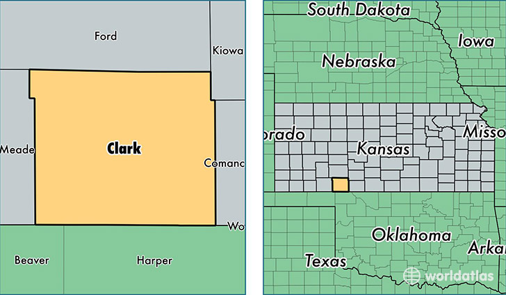
Clark County is a county equivalent area found in Kansas, USA. The county government of Clark is found in the county seat of Ashland.
With a total 2,530.89 sq. km of land and water area, Clark County, Kansas is the 803rd largest county equivalent area in the United States. Home to 2,144 people, Clark County has a total 1132 households earning 41129 on average per year.
Clark County, Kansas - Quick Facts
| FIPS Code | 20025 |
| Area Codes | 620 |
| Time Zone | CST |
| Major Cities | Ashland (population: 1,099), Englewood (population: 101) |
| Land Area | 828 sq miles |
| Water Area | 975 sq miles |
| Household Income | $41,129 |
| Housing Units | 1,132 |
| Median Home Value | $59,800 |
| High School Grads | 92% of population |
| Holders of Bachelors Degrees | 26% of population |
| Retail Spending | $4,775 per capita |
This page was last updated on June 30, 2016.