Where is Fayette County, Alabama?
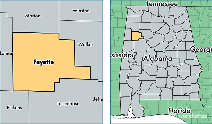
Fayette County is a county equivalent area found in Alabama, USA. The county government of Fayette is found in the county seat of Fayette.
With a total 1,630.02 sq. km of land and water area, Fayette County, Alabama is the 1643rd largest county equivalent area in the United States. Home to 16,874 people, Fayette County has a total 8364 households earning 33838 on average per year.
Fayette County, Alabama - Quick Facts
| FIPS Code | 1057 |
| Area Codes | 205 |
| Time Zone | CST |
| Major Cities | Fayette (population: 10,030), Winfield (population: 7,679), Berry (population: 3,887), Eldridge (population: 1,169), Bankston (population: 1,005), Belk (population: 98), Glen Allen (population: 56) |
| Land Area | 6,515 sq miles |
| Water Area | 628 sq miles |
| Household Income | $33,838 |
| Housing Units | 8,364 |
| Median Home Value | $71,400 |
| High School Grads | 75% of population |
| Holders of Bachelors Degrees | 13% of population |
| Retail Spending | $7,433 per capita |
| Food & Accomodation Sales | $10,869 per capita |
This page was last updated on June 30, 2016.