Where is Clay County, Alabama?
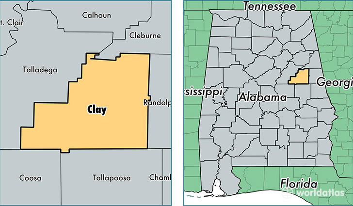
Clay County is a county equivalent area found in Alabama, USA. The county government of Clay is found in the county seat of Ashland.
With a total 1,569.54 sq. km of land and water area, Clay County, Alabama is the 1723rd largest county equivalent area in the United States. Home to 13,552 people, Clay County has a total 6699 households earning 34002 on average per year.
Clay County, Alabama - Quick Facts
| FIPS Code | 1027 |
| Area Codes | 256 |
| Time Zone | CST |
| Major Cities | Lineville (population: 5,402), Ashland (population: 4,920), Delta (population: 1,562), Cragford (population: 934), Millerville (population: 33), Hollins (population: 6) |
| Land Area | 5,232 sq miles |
| Water Area | 604 sq miles |
| Household Income | $34,002 |
| Housing Units | 6,699 |
| Median Home Value | $79,900 |
| High School Grads | 77% of population |
| Holders of Bachelors Degrees | 9% of population |
| Retail Spending | $5,123 per capita |
| Food & Accomodation Sales | $4,352 per capita |
This page was last updated on June 30, 2016.