Pacific Ring Of Fire
The Pacific Ocean is the world’s largest ocean, spanning over 60 million square miles. It makes up approximately 28% of the Earth’s total surface area and accounts for 46% of the total water surface. This ocean is so big that all the landmasses can fit into it and still have more space. The Ocean was named in 1520 by a Portuguese explorer, Ferdinand Magellan. As Magellan sailed through a peaceful patch of the ocean which had favorable wind, he thought the water body was all calmed and named it “Mar Pacifico,” meaning “Peaceful Sea.” Despite its name, the Pacific Ocean is characterized by numerous activities, some of which are violent and destructive. One of the key features of this vast water body is the Pacific Ring of Fire.
Contents:
- What Is The Pacific Ring Of Fire?
- Location
- Brief History
- Tectonic Plate Subduction
- Volcanoes And Earthquake Distribution
What Is The Pacific Ring Of Fire?
The Pacific Ring of Fire is known variously as Ring of Fire, Circum-Pacific Belt, or Girdle of Fire. It is an underwater region on the edges of the Pacific Ocean where numerous earthquakes and volcanic eruptions take place. The majority of the world’s earthquakes and volcanic activities take place around the Ring of Fire. It is a U-shaped belt of approximately 40,250 kilometers long and 500 kilometers wide, with a chain of over 450 volcanoes. The volcanic activities occur when the Pacific plate collides or slides into other tectonic plates around it. The tectonic plate sliding in some areas around the Ring of Fire has also led to the formation of deep underwater trenches, like the Mariana Trench, the world’s deepest spot.
Location

Although geologists and oceanographers largely agree on most of the regions included within the Ring of Fire, some areas are disputed and remain subject of debate. The region includes much of the Pacific coast of North America, South America, Kamchatka Peninsula, and some of the West Pacific islands. However, there is no consensus on the inclusion of western Indonesia and the Antarctica Peninsula. Indonesia’s location within the Ring of Fire is debatable because it lies partly in the ring and Alpide belt (a region with frequent volcanic eruptions and earthquakes). Thus, some geologists consider the whole of Indonesia as part of the Ring of Fire, while others include only the island’s western part.
For much of its length, the Ring of Fire follows island arc chains, such as New Hebrides, Tonga, Japan, Philippines, Kuril, Solomon Islands, and Fiji. The island arcs on the belt’s path include Central America volcanic arc, North America Cordillera, and Sunda arc. Its boundaries lie between several tectonic plates, including the Pacific, Cocos, Nazca, Indian-Australia, Philippines, and North American. However, the belt does not extend to South America’s southern tip or the southern Pacific Ocean.
Brief History
The Pacific Ring of Fire dates back over 35 million years. However, subduction has been taking place in other parts of the belt for much longer. The Romans and ancient Greeks believed that fires were the main cause of volcanoes. The historical link between fire and volcanoes earned the belt the name “Ring of Fire. The existence of the chains of volcanoes on the Pacific Ocean was first highlighted in the 19th century, first by English volcanologist G. P. Scrope in 1825. However, the volcanoes were first described as a “ring of fire” in the Pacific Ocean by Alexander P Livingston in a book published in 1906. The plate tectonic theory, popularized in the 1960s, has helped in the explanation and understanding of the Ring of Fire's earthquakes and volcanoes distributions.
Tectonic Plate Subduction

The frequent earthquakes and abundant volcanoes along the Ring of Fire result from plate tectonic movement in the region. These tectonic plates end up overlapping at convergent boundaries, referred to as subduction zones (a zone where the top tectonic plate pushes the plate beneath downwards). As subduction takes place, rocks melt and form magma, leading to a volcanic eruption.
The Pacific Ring of Fire formed by the development of several subduction zones. The belt’s first plate configuration took place about 115 million years ago in North America, South America, and Asia. The New Guinea and Indonesian subduction zones formed over 70 million years ago, followed by the recent New Zealand subduction zone approximately 35 million years ago.
The belt’s eastern parts form by the collision of large tectonic plates, while the western parts result from the collision of small and large plates, making the rings more complex. The Ring of Fire in South America resulted from the subduction of Nazca, Antarctica, and Cocos plates below the South American Tectonic Plate. The Cocos Plate’s subduction in Central America is taking place under the Caribbean Plate. The subduction of the Juan de Fuca Plate and part of the Pacific Plate is taking place under the North American Plate. The Pacific plate is also being sub-ducted beneath Kuril and Kamchatka Peninsula, as well as the Aleutian Island arc, along the western and northern portions. Several plates are also being subducted below the Eurasia Plate, including the Philippines, Taiwan, and Japan plates.
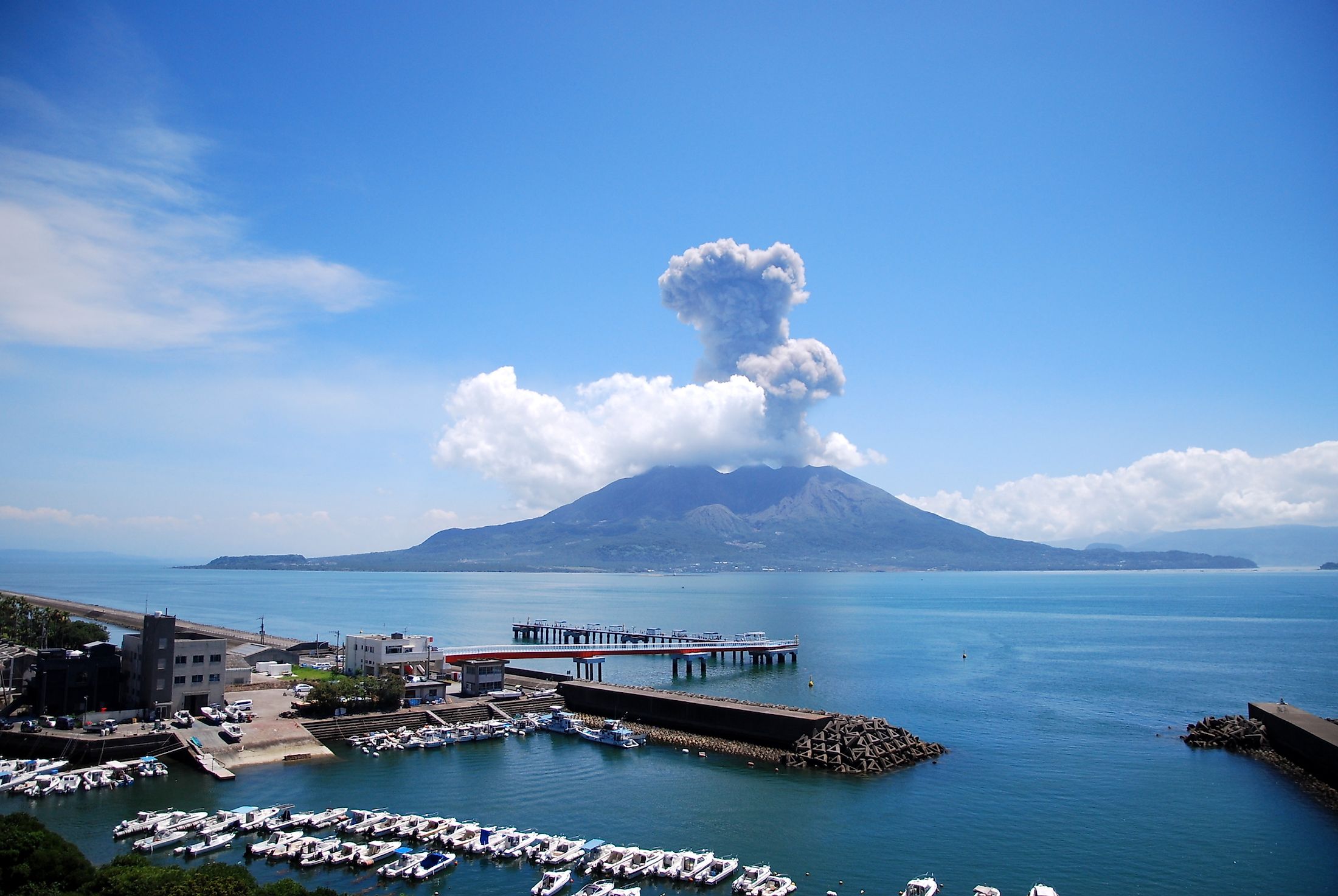
Volcanoes And Earthquake Distribution

The Pacific Ring of Fire contains more than 800 volcanoes that have been active in recent years, with the four world’s largest volcanic eruptions in the current geological epoch (Holocene) occurring in the area. The four eruptions have taken place at Mount Fisher (Alaska), Mount Mazama (Oregon), Kurile Lake (Kamchatka), and Kikai Caldera (Japan).
Most of the Ring’s volcanoes lie within the Asian continent. Of the over 400 Ring volcanoes in Asia (including submarine volcanoes), 109 are within the Russian territory, 81 in Japan, and 70 in western Indonesia. The 25 volcanoes around Northern Marina Islands and Guam are within the US territory. About 152 volcanoes of the Ring of Fire are located within South America, with Chile accounting for 71, Ecuador 21, and 18 are located within the Chile-Argentina border. In North America, the Ring’s volcanoes are about 209, with the US accounting for more than half of the volcanoes.

Ojos del Salado (6,893 meters) of the Andes Mountains is the world’s tallest active volcano. It is located at the Chile-Argentina border. Another belt’s volcano is the Llullaillaco, which rises 6,739 meters. Other ring volcanoes are Mount Tambora, Novarupta, Saint Helens, Krakatoa, and Pinatubo.

Map showing the extent of the Pacific Ring of Fire (area shaded in brown)
Up to 90% of the Earth’s earthquakes occur along the Ring of Fire’s path, including most of the dramatic and violent seismic activities. It is the most seismically active region in the world. Most high magnitude (more than 8.0) earthquakes have occurred in the belt. Some of these powerful seismic activities include the Valdivia earthquake (1960), the Alaska earthquake (1964), and the Tohoku earthquake (2011).


