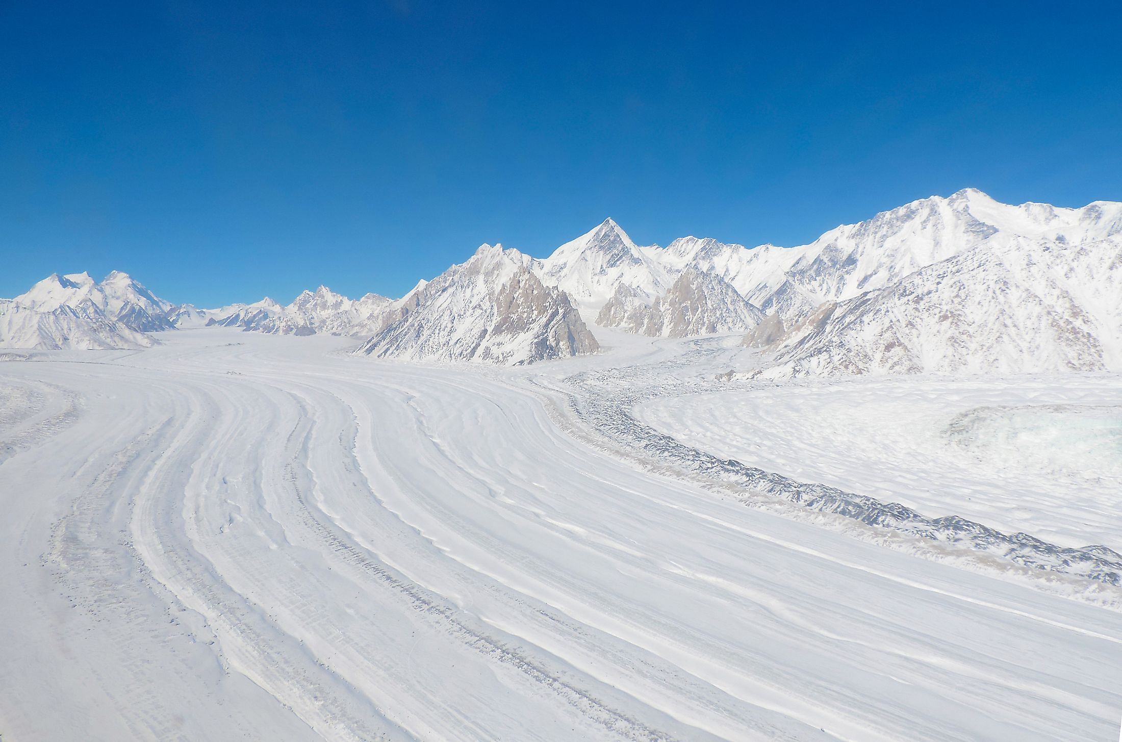
Siachen Glacier
Siachen Glacier, the world’s second-longest glacier in non-polar areas, lies in the Karakoram Range of the Himalayas, in the disputed Kashmir region. The glacier covers 76 km from its head at Indira Col on the China-India border to its terminus, with its altitude falling from 5,753m to 3,620m above sea level. The Siachen Glacier is bordered to the north by the great drainage divide, a divide separating the Indian Subcontinent and the Eurasian Plate in the Karakoram region. Although India administers the entire glacier region as part of the Union Territory of Ladakh, Pakistan also claims the region and controls the area to the glacier’s west.
Geography

At 76 kilometers, the Siachen Glacier is Karakoram Range’s longest glacier and the world’s second-longest non-polar glacier. The glacier lies to the east of the main Karakoram Range and west of the Saltoro Ridge, falling from an elevation of 5,753m at its head in Indira Col to 3,620m at the terminating point. It lies on the northeast of the northernmost point of the Line of Control between Pakistan and India in the disputed Kashmir region. The glacier system covers an area of approximately 700 sq. km, separating Central Asia from Indian Subcontinent.
The Siachen Glacier region experiences an extremely cold climatic condition, with temperatures dropping to -50°C. The winter snowfall is over 1,000 cm, with the area experiencing high-speed winds and avalanches. The Siachen Glacier is the major source of the 80km long Nubra River, a major tributary of the Shyok River. The Shyok River feeds into the 3,180km long Indus River, which is the source of water for the world’s largest irrigation system.
Dispute and Conflict

The Siachen region is a subject of a territorial dispute between Pakistan and India, with both countries claiming sovereignty over it. The 1970s and 1980s US and Pakistani maps contained a dotted line on the LoC from NJ9842 to Karakoram Pass. However, India held that the dotted line violated the Shimla agreement and may have been a cartographic error. India took control of the Siachen Glacier in 1984 under Operation Meghdoot after getting information on Pakistan’s plans to occupy the region. The Pakistani troops reached the area and found that India had already occupied the glacier, including the Saltoro Ridge.
The Siachen Glacier is considered the world’s highest battleground, with India and Pakistan fighting there since 1984. Troops from both countries have maintained their presence in the region up to an elevation of over 6,000m. However, both countries have lost more soldiers to the harsh climate than the conflict itself. According to the Indian authorities, the country lost 869 soldiers in the Siachen Glacier between 1984 and now due to harsh weather conditions. Because of the high cost of military outposts, India and Pakistan wish to resolve the territorial dispute. However, India insists that Pakistan must recognize the current line of control for it to withdraw from the area.
Environmental Concerns
The heavy military presence is a major threat because of the glacier melting and pollution. Both troops depend on glacial ice as the main source of water for their livelihood. However, they use chemicals to cut and melt the glacial ice. Besides, the troops also dump large amounts of wastes, including non-biodegradable material. Thus, the presence of army personal on the glacier is the main cause of glacial retreat. According to a study conducted by the Pakistani Meteorological Department, the glacier size has reduced by about 35% and currently decreasing by 110 meters annually. The military activities have also affected the flora and fauna of the region, with almost all species at risk, including the snow leopard, ibex, and brown bears, that are found here.