Where is Danville City County, Virginia?
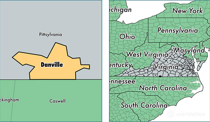
Danville City County is a county equivalent area found in Virginia, USA. The county government of Danville City is found in the county seat of Danville.
With a total 113.83 sq. km of land and water area, Danville City County, Virginia is the 3114th largest county equivalent area in the United States. Home to 42,444 people, Danville City County has a total 22314 households earning 30786 on average per year.
Danville City County, Virginia - Quick Facts
| FIPS Code | 51590 |
| Area Codes | 434 |
| Time Zone | EST |
| Major Cities | Danville (population: 60,140) |
| Land Area | 16,388 sq miles |
| Water Area | 43 sq miles |
| Household Income | $30,786 |
| Housing Units | 22,314 |
| Median Home Value | $87,800 |
| High School Grads | 78% of population |
| Holders of Bachelors Degrees | 17% of population |
| Retail Spending | $19,845 per capita |
| Food & Accomodation Sales | $110,262 per capita |
This page was last updated on June 30, 2016.